All countries of the world listed from A-Z:

or choose from the countries per continent below:


 |  |  |  |  |  |
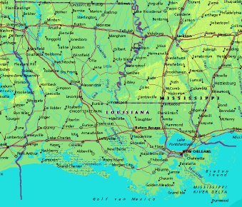 | UNITED STATES OF AMERICA : LOUISIANA
|
| General useful information |
| Note: some data are of constant value, while other are due to changes, fluctuations etc. |
| State and population |
| capital: Baton Rouge // state code ISO: LA ; FIPS: US22 |
| surface: 112843 sq.km = 44960 sq.mi // rank in USA: 33 // location: West South Central |
| climate: subtropical, affected by continental wheater patterns |
| entered USA as 18th state on: 1812-04-30 |
| administrative division: 64 parishes |
| total population according to the census of 2000: 4,468,976 |
| population density 2000: 40 per sq.km = 103 per sq.mi // net growth 1999-2000: 5,9% |
| main ethnic groups: white 63,9%; black 32,5%; Asian 1,2%; other <3% |
| Economy and infrastructure |
| chief crops: soybeans, sugarcane, rice, corn, cotton, sweet potatoes, pecans, sorghum, aquaculture |
| livestock (million): cattle: 0,86 / pigs: 0,03 / poultry: 2,6 |
| timber/lumber: pines, hardwoods, oak |
| chief industries: wholesale & retail trade, tourism, manufacturing, construction, transportation |
| chief industrial products: chemical products, foods, transportation equipment, electronic equipment |
| chief mining products: salt, sulphur, sand & gravel, crushed stone, clays |
| Some physical landmarks |
| highest point in the state: Driskill Mountain 163 m = 535 ft |
| other mountains: of no importance |
| lowest point in the state: a fraction below sea level in the Mississippi Delta |
| lakes: Lake Pontchartrain, Lake Maurepas, Lake Salvador, Calcasieu Lake, Grand Lake, White Lake |
| artificial lakes: Telodo Bend Res., Bayou d'Arbonne Lake, L. Claiborne, L. Bistineau, Catahoula L. |
| rivers: Mississippi, Red River, Ouachita, Bayou Lafourche, Calcasieu |
| others: islands: Marsh Island, Timbalier Island, Isles Dernieres // deserts: none |
| Additional remarks, especially on the statistical information |
| other important features: |
| nick name(s): Pelican State |
| motto: Union, justice, and confidence |
| song: Give Me Louisiana |
| flower: Magnolia // bird: Eastern brown pelican // tree: Cypress |
| primary sources: |
| World almanac and book of facts; National Geographic Atlas of the World; maps: WN world @tlas |
 Back to the page containing general information of the whole country
 To the page containing the population growth statistics of the whole country
 to the secondary administrative division of the state
To the page containing historical population statistics of some important towns of the state
To the page containing urban historical population statistics of the whole country
 Back to the homepage of this website: POPULATION STATISTICS
File created on 2003.02.26 by Jan Lahmeyer
© "populstat" site: Jan Lahmeyer