All countries of the world listed from A-Z:

or choose from the countries per continent below:


 |  |  |  |  |  |
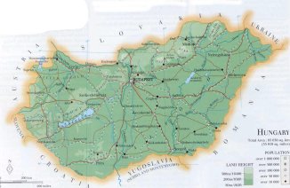 | HUNGARY[Magyarország] : |
| General useful information |
| Note: some data are of constant value, while other are due to changes, fluctuations etc. |
| Nation and population |
| official name (short form): Magyar ; Magyarország |
| country code ISO: HU //; - FIPS: HU |
| location: Central Europe |
| time zone: UT [*= applying daylight saving time] |
| surface (land) area: 93030 sq.km = 35919 sq.mi //; - area incl. inland waters: sq.km = sq.mi |
| geographical position in extreme co-ordinates: North: 48°35' N / South: 45°48' N / East: 22°58' E / West: 16°08' E |
| borders (land): Slovakia, Ukraine, Romania, Yugoslav Federation (Serbia-Montenegro), Croatia, Slovenia, Austria |
| borders (coastline): none |
| climate: moderate continental |
| Government |
| independent since: 896 ; 1001 ; 1867 ; 1918-11-16 |
| type of government: republic |
| capital: Budapest |
| administrative division: megyék [komitat] (19) |
| Population |
| population according to the last two censuses: (1991): 10375,323 // (2001): 10198,315 |
| total population according to the estimate of midyear 2000: 10022,000 /or:/ 10043,224 /or:/ 10,138,844 |
| population density: 108 per sq.km = 280 per sq.mi |
| population growth: -0,4% //; - doubling time: not applicable, declining population |
| birth rate: 9 - 12 per 1000 |
| death rate: 13 per 1000 |
| fertility rate: 2 children per female |
| maternal mortality: 26 per 100,000 |
| infant mortality (1-4 years): 17 per 1000 |
| life expectancy: 72 years (male: 68; female: 75) |
| age breakdown: 0-14 years: 20% //; - 15-59 years: 61% //; - 60+ years: 19% |
| urbanisation: 64% //; - urbanisation growth: 2% |
| percentage of urban population in the greatest city: 37% |
| Ethnic composition, language, religion |
| ethnic groups: Magyar 91%; Roma 4%; German 1,6%; Slovak 1,1%; other 1% |
| languages: Hungarian, Slovak, German |
| religious affiliation: Roman Catholic 63%; Calvinist 20%; Lutheran 5%; other, or non religious 12% |
| Health |
| daily food intake: 3749 calories per capita |
| population with access to safe water: 99% |
| people per physician: 276 |
| people per hospital bed: 127 |
| Education, literacy |
| school enrolment: primary education 6-11 years: 94% |
| school enrolment: secondary education: 76% |
| school enrolment: tertiary education 20-24 years: 15% |
| adult literacy: 99% (male: %; female: %) |
| Economy and infrastructure |
| Economy and trade |
| currency: Forint = 100 filler |
| annual inflation rate: 19% |
| population below poverty line: 9% |
| Gross Domestic Product: USD 4120 per capita |
| GNI USD 4710 per capita //; - [ppp: 11990] |
| GDP growth: 2% |
| income: USD 2690 per capita |
| import: USD 15446 per capita //; - export: USD 12867 per capita |
| trade: USD 2109 per capita //; - or 132% of GDP |
| trade partners: DE CIS AT CS IT FR GB US |
| human development index: 0,829 //; - position of the country in the world no.: 36 |
| female labour force: 45% |
| unemployment: 6% |
| tourism: 16 million |
| Economic activities in agriculture, fisheries, industry, mining, services, energy |
| land use: arable land: 57% //; - grass land: 13% //; - wooded area: 18% //; - arid land and desert: % |
| agriculture: labour force: 21% //; - part of agriculture in GDP: 10% |
| agricultural products: meat, cereals, wine, sunflowers, potatoes, sugar beets |
| livestock (1000s): cattle: 857 / goats: 189 / horses: 65 / pigs: 5335 / poultry: 25894 / sheep: 934 |
| fish catch: 7514 - 21916 metric tonnes |
| industry: labour force: 31% //; - part of industry in GDP: 34% |
| industrial products: machinery, transport equipment, steel, construction materials, food processsing, pharmaceuticals |
| mining products: bauxite, coal, natural gas |
| CO2 emission per capita: 5,8 |
| services: labour force: 48% //; - part of services in GDP: 56% |
| energy use (kg per capita): 2512 |
| electricity use (per capita): 2874 |
| annual water use (per capita): 661 |
| Traffic, communication |
| road network: 29832 km //; - of which paved: 93% //; - of which are motorways: 448 km |
| vehicles: 185 per 1000 |
| railways: 7765, or: 13181 km //; - railways passenger/km: 9358 |
| navigable inland waterways: 1688 km |
| ownership telephone: 185 - 371 per 1000 |
| ownership radio receivers: 733 per 1000 |
| ownership tv-sets: 447 per 1000 |
| newspaper circulation: 228 per 1000 |
| persons per post office: 3170 |
| personal computers: 85 per 1000 |
| Some physical landmarks |
| mountains: Mátra (Kékes) 1015 m, Bükk (Istállós) 959, Börzsöny (Csóványos) 939, Nagy-Milic 896, Írott-ko 883, Pilis 757 |
| lowest point: ca 79 m south of Szeged where the river Tisza leaves the country |
| lakes (natural): Balaton (596 sq.km; depth 4m), Fertö tó (338 sq.km, of which 1/3 part belongs to Hungary), Velencei tó 26 sq.km |
| lakes (artificial reservoirs): Kiskörei-víztáraló |
| lakes (deepest): unknown |
| rivers: Duna (or: Danube, 417 km in Hungary), Tisza (or: Theiss, 597), Rába 192, Zagyva 179, Dráva 143, Sajó 132, Körös |
| canals: Keleti-föcsatorna, Tiszakaradi föcsatorna, Hanság-csatorna |
| waterfalls: none, or unknown |
| caves: longest system: Baradla near Aggtelek ? / deepest: |
| islands: none |
| deserts: none |
| other natural features: |
| Additional remarks, especially on the statistical information |
| other important features: |
| apart from physical landmarks most of the above figures are changeable, in most cases they date from the 1990's |
| if there is a range between the figures, the differences are due to the use of several sources |
| primary sources used for the general information: |
| BB CA EV PW WA WB WR, and some national statistical yearbooks |
| particulars concerning population data: |
 To the page containing the population growth statistics of the country
 To the page containing urban historical population statistics
 Back to the homepage of this website: POPULATION STATISTICS
Internet website: Internet website:Latest modification of this page on 2004-02-16 by Jan Lahmeyer
© "populstat" site: Jan Lahmeyer
 To the page containing the historical population growth statistics of the actual administrative division