All countries of the world listed from A-Z:

or choose from the countries per continent below:


 |  |  |  |  |  |
 | UNITED STATES OF AMERICA : MICHIGAN
|
| General useful information |
| Note: some data are of constant value, while other are due to changes, fluctuations etc. |
| State and population |
| capital: Lansing // state code ISO: MI ; FIPS: US26 |
| surface: 147139 sq.km = 56813 sq.mi // rank in USA: 22 // location: East North Central |
| climate: well-defined seasons tempered by the Great Lakes |
| entered USA as 26th state on: 1837-01-26 |
| administrative division: 83 counties |
| total population according to the census of 2000: 9,938,444 |
| population density 2000: 68 per sq.km = 175 per sq.mi // net growth 1999-2000: 6,9% |
| main ethnic groups: white 80,2%; black 14,2%; Asian 1,8%; Native American/Nat. AK 0,6%; other 3% |
| Economy and infrastructure |
| corn, wheat, soybeans, dry beans, hay, potatoes, sweet corn, apples, cherries, sugar beets |
| livestock (million): cattle: 0,98 / pigs: 0,95 / poultry: 7,6 ; broilers 0,75 / sheep: 0,071 |
| timber/lumber: maple, oak, aspen |
| chief industries: manufacturing, services, tourism, agriculture, forestry/lumber |
| chief industrial products: automobiles, transportation equipment, machinery, fabricated metals |
| chief mining products: portland cement, iron ore, sand & gravel, magnesium compounds, crushed stone |
| Some physical landmarks |
| highest point in the state: Mt. Arvon (Curwood) 604 m = 1980 ft |
| other mountains: Porcupine Mts. 597 |
| lowest point in the state: ca 174 m (level of Lake Erie) |
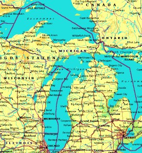
| lakes: Lake Michigan, Lake Huron, Lake Superior, Lake Erie, Lake St. Clair, Houghton Lake |
| artificial lakes: there could be a few relatively small ones, but they are hardly recognisable on maps |
| rivers: Muskegon, Grand, Kalamazoo, Escanaba, Menominee, St. Joseph |
| others: islands: Beaver Island, Bois Blanc Island, North Manitou Island, South Fox Island // deserts: none |
| Additional remarks, especially on the statistical information |
| other important features: |
| nick name(s): Great Lakes State, Wolverine State |
| motto: Si Quaeris Peninsulam Amoenam, Circumspice (If you seek a pleasant peninsula, look about you) |
| song: Michigan, My Michigan |
| flower: Apple blossom // bird: Robin // tree: White pine |
| primary sources: |
| World almanac and book of facts; National Geographic Atlas of the World; maps: WN world @tlas |
 Back to the page containing general information of the whole country
 To the page containing the population growth statistics of the whole country
 to the secondary administrative division of the state
To the page containing historical population statistics of some important towns of the state
To the page containing urban historical population statistics of the whole country
 Back to the homepage of this website: POPULATION STATISTICS
File created on 2003.03.01 by Jan Lahmeyer
© "populstat" site: Jan Lahmeyer