All countries of the world listed from A-Z:

or choose from the countries per continent below:


 |  |  |  |  |  |
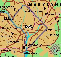 | UNITED STATES OF AMERICA : DISTRICT OF COLUMBIA
|
| General useful information |
| Note: some data are of constant value, while other are due to changes, fluctuations etc. |
| State and population |
| capital: Washington // state code ISO: DC ; FIPS: US11 |
| surface: 159 sq.km = 61 sq.mi // rank in USA: 50 // location: NE |
| climate: hot humid summers, mild winters |
| entered USA as ..th? state on: 1874?-- |
| administrative division: not known; DC is coexistensive with the city of Washington |
| total population according to the census of 2000: 572,059 |
| population density 2000: 3598 per sq.km = 9378 per sq.mi // net growth 1999-2000: -5,7% |
| main ethnic groups: white 31%; black 60%; Asian 3%; Hawaiian/ Pacific Islander 4%; other 2% |
| Economy and infrastructure |
| chief crops: none, because this is a totally urbanized state |
| livestock (million): none |
| timber/lumber: none |
| chief industries: government, service, tourism |
| chief industrial products: none |
| chief mining products: none |
| Some physical landmarks |
| highest point in the state: 410 ft (not specified by name on maps available at compiler of this site) |
| other mountains: none |
| lowest point in the state: sea level |
| lakes: none |
| artificial lakes: McMillan Res. |
| rivers: Potomac, Anacostia, Rock Creek |
| others: islands: East Potomac Park, Columbia Island, Theodore Roosevelt Island // deserts: none |
| Additional remarks, especially on the statistical information |
| other important features: |
| nick name(s): none |
| motto: Justitia omnibus (Justice for all) |
| song: none? |
| flower: American beauty rose // bird: Wood trush // tree: Scarlet oak |
| primary sources: |
| World almanac and book of facts; National Geographic Atlas of the World; maps: WN world @tlas |
 Back to the page containing general information of the whole country
 To the page containing the population growth statistics of the whole country
 To the page containing urban historical population statistics of the whole country
 Back to the homepage of this website: POPULATION STATISTICS
File created on 2003.02.20 by Jan Lahmeyer
© "populstat" site: Jan Lahmeyer