All countries of the world listed from A-Z:

or choose from the countries per continent below:


 |  |  |  |  |  |
 | VIETNAMgeneral data of the country |
| General useful information |
| Note: some data are of constant value, while other are due to changes, fluctuations etc. |
| Nation and population |
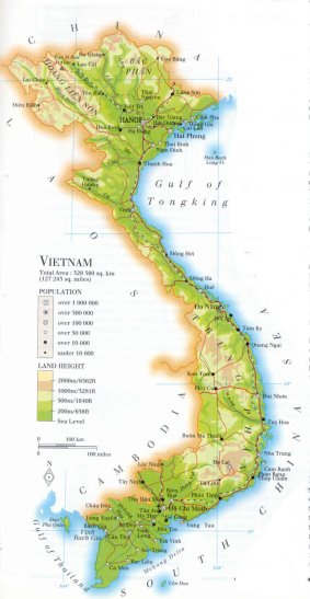
| official name (short form): Viêt Nam |
| country code ISO: VN //; - FIPS: VM |
| location: Southeast Asia |
| time zone: +7 UT |
| surface (land) area: 331041 sq.km = 127816 sq.mi //; - area incl. inland waters: sq.km = sq.mi |
| geographical position in extreme co-ordinates: North: 23° N / South: 8° N / East: 109° E / West: 102° E |
| borders (land): Cambodia, Laos, China |
| borders (coastline): South China Sea |
| climate: north: relatively cool, south tropical |
| Government |
| independent since: 1945-09-02 ; 1954 ; 1976 |
| type of government: republic |
| capital: Hà Nôi |
| administrative division: region (7) into province (50) + municipality (2) and capital (1) |
| Population |
| population according to the latest census (1989): 64411,713 |
| total population according to the estimate of midyear 2000: 78773,873; or: 78523,000 /-; 2001: 79175,000; or: 79939,014 |
| population density: 238 per sq.km = 616 per sq.mi |
| population growth: 2% //; - doubling time: ca 30 years |
| birth rate: 21 - 26 per 1000 |
| death rate: 6 - 7 per 1000 |
| fertility rate: 3 - 4 children per female |
| maternal mortality: 140 per 100,000 |
| infant mortality (1-4 years): 38 per 1000 |
| life expectancy: 69 years (male: 67; female: 72) |
| age breakdown: 0-14 years: 39% //; - 15-59 years: 54% //; - 60+ years: 7% |
| urbanisation: 20% //; - urbanisation growth: 3% |
| percentage of urban population in the greatest city: 21% |
| Ethnic composition, language, religion |
| ethnic groups: Vietnamese (Kinh) 87%; Hoa Chinese 2%; Meo 2%; Thai 2%; Khmer 1%; Muong 1%; Nung 1%; others: Man, Cham, Tay, Khome |
| languages: Vietnamese (official); Chinese, Tho, Khmer, Muong, Thai, Nung, Miao, Jarai, Rhadé, Hre, Bahnar, French, English |
| religious affiliation: Buddhist 67%; Roman Catholic 8%; Taoist, indigenous beliefs |
| Health |
| daily food intake: 2422 calories per capita |
| population with access to safe water: 56% |
| people per physician: 2283 |
| people per hospital bed: 380 |
| Education, literacy |
| school enrolment: primary education 6-11 years: 57% |
| school enrolment: secondary education: 42% |
| school enrolment: tertiary education 20-24 years: 3% |
| adult literacy: 94% (male: 96,5%; female: 91%) |
| Economy and infrastructure |
| Economy and trade |
| currency: dong = 10 hao = 100 xu |
| annual inflation rate: 15% |
| population below poverty line: 51% |
| Gross Domestic Product: USD 200 per capita |
| GNI USD 390 per capita //; - [ppp: 2000] |
| GDP growth: 6% |
| income: USD 300 per capita |
| import: USD 3924 per capita //; - export: USD 2985 per capita |
| trade: USD 60 per capita //; - or 96% of GDP |
| trade partners: SG FR JP CN |
| human development index: 0,682 //; - position of the country in the world no.: 101 |
| female labour force: 49% |
| unemployment: 7% |
| tourism: 2 million |
| Economic activities in agriculture, fisheries, industry, mining, services, energy |
| land use: arable land: 20% //; - grass land: 1% //; - wooded area: 30% //; - arid land and desert: % |
| agriculture: labour force: 68% //; - part of agriculture in GDP: 42% |
| agricultural products: rice, sugarcane, cassava, cashew nuts, fish, potatoes, soybeans, coffee, tea, corn/maize |
| livestock (million): buffalo: 3 / cattle: 4 / goats: 0,5 / pigs: 20 / poultry: 112-137 / [ducks 60?] |
| fish catch: 1200000 - 1550000 metric tonnes |
| industry: labour force: 12% //; - part of industry in GDP: 25% |
| industrial products: cement, fish sauce, food processing, garments, shoes, chemical fertilizer |
| mining products: phosphate rock, gold, coal, oil, tin, zinc, iron, antimony, apatite, salt, bauxite, gas, manganese, chromate |
| CO2 emission per capita: 0,6 |
| services: labour force: 21% //; - part of services in GDP: 33% |
| energy use (kg per capita): 454 |
| electricity use (per capita): 252 |
| annual water use (per capita): 414 |
| Traffic, communication |
| road network: 85700, or 106048 km //; - of which paved: 26% //; - of which are motorways: 0 km |
| vehicles: 2,5 per 1000 |
| railways: 2652 km //; - railways passenger/km: 2100 |
| navigable inland waterways: 17702 km |
| ownership telephone: 11 - 27 per 1000 |
| ownership radio receivers: 95 - 109 per 1000 |
| ownership tv-sets: 47 - 182 per 1000 |
| newspaper circulation: 8 per 1000 |
| persons per post office: |
| personal computers: 9 per 1000 |
| Some physical landmarks |
| mountains: Fan Si Pan 3143 m, P. Si Lung 3076, Phu Luong 2983, Lang Cung 2913 |
| lowest point: sea level |
| lakes (natural): none, or unknown |
| lakes (artificial reservoirs): a few ones |
| lakes (deepest): unknown |
| rivers: Hong (Red River), Tien Giang (Mekong), Da Rang, Da (Black River) Ma, Ca, Chu |
| canals: none, or unknown |
| waterfalls: none, or unknown |
| caves: longest system: none, or unknown / deepest: |
| islands: Ðao Phu Quôc, Côn Ðao, Ðao Bach Long Vi |
| deserts: none |
| other natural features: |
| Additional remarks, especially on the statistical information |
| other important features: |
| apart from physical landmarks most of the above figures are changeable, in most cases they date from the 1990's |
| primary sources used for the general information: |
| BB CA EV PW WA WB WR, and some national statistical yearbooks |
| particulars concerning population data: |
 To the page containing the population growth statistics of the country
 To the page containing the historical population growth statistics of the provinces
 To the page containing urban historical population statistics
 Back to the homepage of this website: POPULATION STATISTICS
Internet website: Internet website:Latest modification of this page on 2004-03-14 by Jan Lahmeyer
© "populstat" site: Jan Lahmeyer