All countries of the world listed from A-Z:

or choose from the countries per continent below:


 |  |  |  |  |  |
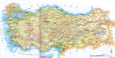 | TURKEY[Türkiye] : |
| General useful information |
| Note: some data are of constant value, while other are due to changes, fluctuations etc. |
| Nation and population |
| official name (short form): Türkiye |
| country code ISO: TR //; - FIPS: TU |
| location: Eastern Mediterranean, Western Asia, SE Europe |
| time zone: -2 UT* [*= applying daylight saving time] |
| surface (land) area: 779450 sq.km = 300948 sq.mi //; - area incl. inland waters: sq.km = sq.mi |
| geographical position in extreme co-ordinates: north: 42 06 N / south: 35 51 N / east: 44 48 E / west: 25 40 E |
| climate: coastal regions: Mediterranean; interior: continental, mountainous |
| borders (land): Georgia 276 km, Armenia 325, Azerbaijan 18, Iran 529, Iraq 378, Syria 877, Greece 203, Bulgaria 269; total 2875 km |
| borders (coastline): Anatolian coast (Black Sea ): 6480, Thracian coast 786, islands: 1067; total 8333 km |
| Government |
| independent since: 1923-10-29 |
| type of government: republic |
| capital: Ankara |
| administrative division: wilayet [=province] (80) |
| Population |
| population according to the last two censuses (1990): 56473,035; (1997:) 62810,111; or: 62865,574 |
| total population according to the estimate of midyear 2000: 65666,677; or: 65239,000; 2001: 66493,970; or: 66921,000 //; or: 2002: |
| population density: per 85 sq.km = 22 per sq.mi |
| population growth: 2,5% //; - doubling time: 36 years |
| birth rate: 18-25 per 1000 |
| death rate: 6 per 1000 |
| fertility rate: 3 children per female |
| maternal mortality: 210 per 100,000 |
| infant mortality (1-4 years): 46 per 1000 |
| life expectancy: 71 years (male: 69; female: 74) |
| age breakdown: 0-14 years: 35% //; - 15-59 years: 58% //; - 60+ years : 7% |
| urbanisation: 75% //; - urbanisation growth: 4,5% |
| percentage of urban population in the greatest city: 24% |
| Ethnic composition, language, religion |
| ethnic groups: Turkish 85,7%; Kurdish 11%; Arabic 1,5%; other 1,8% |
| languages: Turkish (official); Kurdish, Arabic, Armenian, Greek |
| religious affiliation: Sunnî Muslim ca 80%, Alevi (nonorthodox Shî'î sect) 20%, Christian ca 0,2% |
| Health |
| daily food intake: 3554 calories per capita |
| population with access to safe water: 75-83% |
| people per physician: 867 |
| people per hospital bed: 431 |
| Education, literacy |
| school enrolment: primary education 6-11 years: 84% |
| school enrolment: secondary education: 46% |
| school enrolment: tertiary education 20-24 years: 11% |
| adult literacy: ca 85% (male: 94%; female: 76%) |
| Economy and infrastructure |
| Economy and trade |
| currency: Turkish lira = 100 kurush |
| annual inflation rate: 76% |
| population below poverty line: 13% |
| Gross Domestic Product: USD 2450 per capita |
| GNI USD 3100 per capita //; - [ppp: 7030] |
| GDP growth: 2% |
| income: USD 1820 per capita |
| import: USD 35707 per capita //; - export: USD 21599 per capita |
| trade: USD 586 per capita //; - or 40% of GDP |
| trade partners: DE US IT FR CIS GB |
| human development index: 0,735 //; - position of the country in the world no.: 82 |
| female labour force: 38% |
| unemployment: 7% |
| tourism: 9,6 million |
| Economic activities in agriculture, fisheries, industry, mining, services, energy |
| land use: arable land: 36% //; - grass land: 11% //; - wooded area: 26% //; - arid land and desert: % |
| agriculture: labour force: 47% //; - part of agriculture in GDP: 18% |
| agricultural products: wheat, sugar beets, barley, potatoes, grapes, apples, seed cotton, maize, fruit, tobacco, pulses, citrus, olives |
| livestock (million): asses: 0,6 / buffalo: 0,2 / cattle: 11 / goats: 8 / horses: 0,3 / mules: 0,1 / pigs: 0,03 / poultry: 205 / sheep: 29 |
| fish catch: 500260 - 575100 metric tonnes |
| industry: labour force: 15% //; - part of industry in GDP: 34% |
| industrial products: refined petroleum, textiles, food products, transport equipment, electrical machinery, stell |
| mining products: chromium, copper, borax, coal, natural gas, bauxite, iron, pumice, celestite, antimony, mercury |
| CO2 emission per capita: 3,2 |
| services: labour force: 39% //; - part of services in GDP: 48% |
| energy use (kg per capita): 1093 |
| electricity use (per capita): 1396 |
| annual water use (per capita): 585 |
| Traffic, communication |
| road network: 62627 km //; - of which paved: 34% //; - of which are motorways: 1746 km |
| vehicles: 25 per 1000 |
| railways: 8452, or 8671 km //; - railways passenger/km: 6385 |
| navigable inland waterways: 1200 km |
| ownership telephone: 215-265 per 1000 |
| ownership radio receivers: 141-181 per 1000 |
| ownership tv-sets: 240-332 per 1000 |
| newspaper circulation: 44 per 1000 |
| persons per post office: 1970 |
| personal computers: 38 per 1000 |
| Some physical landmarks |
| mountains: Büyük Agri dagi 5137 m, Uludoruk 4135, Buzul d. 4116, Suphan d. 4058, Kackar d. 3932, Erciyes d. 3917 |
| lowest point: sea level |
| lakes (natural): Van Gölü 3713 sq.km, Tuz G. 1500, Beysehir G. 656, Egridir G. 468, Aksehir G. 353, Iznik G. 298 |
| lakes (artificial reservoirs): Atatürk Baraji 817 sq.km, Keban B. 675, Karakaya B. 298, Hirfanli B. 263 |
| lakes (deepest): |
| rivers: Kizilirmak 1335 km, Firat (Euphrates), Sakarya, Murat, Dicle (Tigris), Seyhan, Göksu, Çoruh, Büyük Menderes |
| canals: |
| waterfalls: in the Eastern Anatolian Mountains, in the West Pamukkale is famous, although this is not really a fall |
| caves: longest system: / deepest: |
| islands: Gökçeada 279 sq.km, Marmara Adasi 117, Bozcaada 36, Uzunada 25, Alibey 23, Pasalimani 21, Avsar 21 |
| deserts: |
| other natural features: |
| Additional remarks, especially on the statistical information |
| other important features: |
| apart from physical landmarks most of the above figures are changeable, in most cases they date from the 1990's |
| primary sources used for the general information: |
| BB CA EV PW WA WB WR, and some national statistical yearbooks |
| particulars concerning population data: |
 To the page containing the population growth statistics of the country
 To the page containing the historical population growth statistics of the provinces
 To the page containing urban historical population statistics
 Back to the homepage of this website: POPULATION STATISTICS
Internet website: Internet website:Latest modification of this page on 2004-01-12 by Jan Lahmeyer
© "populstat" site: Jan Lahmeyer