All countries of the world listed from A-Z:

or choose from the countries per continent below:


 |  |  |  |  |  |
 | VENEZUELAgeneral data of the country |
| General useful information |
| Note: some data are of constant value, while other are due to changes, fluctuations etc. |
| Nation and population |
| official name (short form): Venezuela |
| country code ISO: VE //; - FIPS: VE |
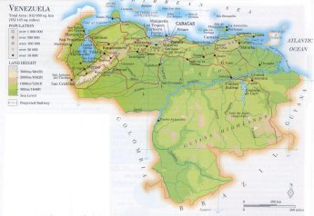
| location: Northern South America |
| time zone: -4 UT |
| surface (land) area: 912050 sq.km = 352144 sq.mi //; - area incl. inland waters: sq.km = sq.mi |
| geographical position in extreme co-ordinates: North: 12° N / South: 1° N / East: 60° W / West: 73° W |
| borders (land): Guyana, Brazil, Colombia |
| borders (coastline): Caribbean Sea, Atlantic Ocean |
| climate: tropical |
| Government |
| independent since: 1811-07-05 ; 1830 |
| type of government: republic |
| capital: Caracas |
| administrative division: estado (22) + dependencias federales (1), Distrito Federal (1) |
| Population |
| population according to the last two censuses: (1990): 19405,429 /-; (2001, provisional data): 22621,491 |
| total population according to the estimate of midyear 2000: 23542,649; or: 24170,000 /-; 2001: 23916,810 |
| population density: 26 per sq.km = 67 per sq.mi |
| population growth: 2,5% //; - doubling time: 33 years |
| birth rate: 21 - 26 per 1000 |
| death rate: 5 per 1000 |
| fertility rate: 3 - 4 children per female |
| maternal mortality: 59 per 100,000 |
| infant mortality (1-4 years): 28 per 1000 |
| life expectancy: 73 years (male: 70; female: 76,5) |
| age breakdown: 0-14 years: 38% //; - 15-59 years: 56% //; - 60+ years: 6% |
| urbanisation: 87% //; - urbanisation growth: 4% |
| percentage of urban population in the greatest city: 26% |
| Ethnic composition, language, religion |
| ethnic groups: mestizo 67%; white 21%; black 10%; Amerindian 2% |
| languages: Spanish (official) |
| religious affiliation: Roman Catholic 92,7%; other 7,3% |
| Health |
| daily food intake: 2358 calories per capita |
| population with access to safe water: 84% |
| people per physician: 804 |
| people per hospital bed: 585 |
| Education, literacy |
| school enrolment: primary education 6-11 years: 89% |
| school enrolment: secondary education: 56% |
| school enrolment: tertiary education 20-24 years: 28% |
| adult literacy: 92% (male: 93%; female: 91%) |
| Economy and infrastructure |
| Economy and trade |
| currency: Bolívar = 100 céntimos |
| annual inflation rate: 45,5% |
| population below poverty line: 31% |
| Gross Domestic Product: USD 8860 per capita |
| GNI USD 4310 per capita //; - [ppp: 5740] |
| GDP growth: -0,6% |
| income: USD 2610 per capita |
| import: USD 10791 per capita //; - export: USD 18914 per capita |
| trade: USD 1288 per capita //; - or 40% of GDP |
| trade partners: US JP DE CO IT |
| human development index: 0,765 //; - position of the country in the world no.: 61 |
| female labour force: 35% |
| unemployment: 12% |
| tourism: 0,6 million |
| Economic activities in agriculture, fisheries, industry, mining, services, energy |
| land use: arable land: 4% //; - grass land: 20% //; - wooded area: 34% //; - arid land and desert: % |
| agriculture: labour force: 13% //; - part of agriculture in GDP: 5% |
| agricultural products: sugarcane, bananas, maize, rice, plantains, oranges, sorghum, cassava |
| livestock (million): asses: 0,4 / cattle: 15,8 / goats: 3,8 / horses: 0,5 / pigs: 5,4 / poultry: 110 / sheep: 0,8 |
| fish catch: 411877 - 502728 metric tonnes |
| industry: labour force: 17% //; - part of industry in GDP: 47% |
| industrial products: food products, chemicals, base metals, beverages, transport equipment, steel, textiles, oil products |
| mining products: oil, bauxite, iron, natural gas, coal, gold, limestone, diamonds |
| CO2 emission per capita: 6,7 |
| services: labour force: 70% //; - part of services in GDP: 48% |
| energy use (kg per capita): 2253 |
| electricity use (per capita): 2493 |
| annual water use (per capita): 382 |
| Traffic, communication |
| road network: 100571 km //; - of which paved: 34% //; - of which are motorways: 2250 km (Pan-American Highway 1290) |
| vehicles: 82 per 1000 |
| railways: 542, or 627 km //; - railways passenger/km: 31 |
| navigable inland waterways: 7100 km |
| ownership telephone: 110 per 1000 |
| ownership radio receivers: 372 - 472 per 1000 |
| ownership tv-sets: 180 - 185 per 1000 |
| newspaper circulation: 215 per 1000 |
| persons per post office: 49200 |
| personal computers: 46 per 1000 |
| Some physical landmarks |
| mountains: Pico Bolívar 5007 m, Pic Concha 4700, more peaks (no names found in atlantes) 4006 m, etc. |
| lowest point: sea level |
| lakes (natural): Lago de Valencia |
| lakes (artificial reservoirs): Embalse de Guri |
| lakes (deepest): unknown |
| rivers: Orinoco, including tributaries like: Meta, Apure, Caura, Caroní |
| canals: none, or unknown |
| waterfalls: Salto del Angel (Angel Falls) drop: 979 m [highest of the world]; near Auyán Tepui 2957 m; Cuquenan 696 m |
| caves: longest system: none, or unknown / deepest: |
| islands: Isla de Margarita, Isla La Tortuga and some other islets |
| deserts: none |
| other natural features: |
| Additional remarks, especially on the statistical information |
| other important features: |
| apart from physical landmarks most of the above figures are changeable, in most cases they date from the 1990's |
| primary sources used for the general information: |
| BB CA EV PW WA WB WR, and some national statistical yearbooks |
| particulars concerning population data: |
 To the page containing the population growth statistics of the country
 To the page containing the historical population growth statistics of the provinces
 To the page containing urban historical population statistics
 Back to the homepage of this website: POPULATION STATISTICS
Internet website: Internet website:Latest modification of this page on 2004-03-14 by Jan Lahmeyer
© "populstat" site: Jan Lahmeyer