All countries of the world listed from A-Z:

or choose from the countries per continent below:


 |  |  |  |  |  |
 | MAURITIUSgeneral data of the country |
| General useful information |
| Note: some data are of constant value, while other are due to changes, fluctuations etc. |
| Nation and population |
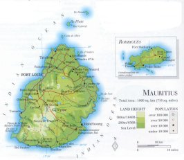
| official name (short form): Mauritius |
| country code ISO: MU //; - FIPS: MP |
| location: East Africa |
| time zone: +4 UT |
| surface (land) area: 1865 sq.km = 720 sq.mi //; - area incl. inland waters: 2040 sq.km = 788 sq.mi |
| geographical position in extreme co-ordinates: North: 10° S / South: 21° S / East: 64° E / West: 55° E |
| borders (land): none |
| borders (coastline): Indian Ocean |
| climate: subtropical humid |
| Government |
| independent since: 1968-03-12 |
| type of government: republic |
| capital: Port Louis |
| administrative division: district (9) + dependency (3); since 1991 also urban council (5) |
| Population |
| population according to the last two censuses (1990): 1056,827 / -; (2000): 1143,069 |
| total population according to the estimate of midyear 2000: 1179,368; or: 1186,000 / -; 2001: 1156,000 |
| population density: 616 per sq.km = 1597 per sq.mi |
| population growth: 1,3% //; - doubling time: 54 years |
| birth rate: 16 - 17 per 1000 |
| death rate: 6 - 7 per 1000 |
| fertility rate: 2 children per female |
| maternal mortality: 100 per 100,000 |
| infant mortality (1-4 years): 22 per 1000 |
| life expectancy: 71 years (male: 67; female: 75) |
| age breakdown: 0-14 years: 29% //; - 15-59 years: 63% //; - 60+ years: 8% |
| urbanisation: 41% //; - urbanisation growth: % |
| percentage of urban population in the greatest city: % |
| Ethnic composition, language, religion |
| ethnic groups: Indian 66%; Creole 27%; European 4%; Chinese 3% |
| languages: English (official); Creole, French, Indian languages (mainly Hindi & Bojpoori) |
| religious affiliation: Hindu 51%; Roman Catholic 27%; Muslim 16%; other 6% |
| Health |
| daily food intake: 1180 calories per capita |
| population with access to safe water: 98% |
| people per physician: 1180 |
| people per hospital bed: |
| Education, literacy |
| school enrolment: primary education 6-11 years: 82% |
| school enrolment: secondary education: 31% |
| school enrolment: tertiary education 20-24 years: 2% |
| adult literacy: 83% (male: %; female: %) |
| Economy and infrastructure |
| Economy and trade |
| currency: Mauritian rupee = 100 cents |
| annual inflation rate: 6% |
| population below poverty line: 11,5% |
| Gross Domestic Product: USD 3180 per capita |
| GNI USD 3750 per capita //; - [ppp: 9940] |
| GDP growth: 4% |
| income: USD 2420 per capita |
| import: USD 2023 per capita //; - export: USD 1556 per capita |
| trade: USD 2586 per capita //; - or 82% of GDP |
| trade partners: GB FR US DE CH JP ZA |
| human development index: 0,765 //; - position of the country in the world no.: 63 |
| female labour force: 34% |
| unemployment: % |
| tourism: 0,7 million |
| Economic activities in agriculture, fisheries, industry, mining, services, energy |
| land use: arable land: 57% //; - grass land: 4% //; - wooded area: 31% //; - arid land and desert: % |
| agriculture: labour force: 19% //; - part of agriculture in GDP: 11% |
| agricultural products: sugar cane, tea, potatoes, tomatoes, bananas, onions, pineappels, cabbages, corn/maize |
| livestock (1000s): cattle: 27 / goats: 94 / pigs: 20 / poultry: 4427 / sheep: 7 |
| fish catch: 12004 - 13852 metric tonnes |
| industry: labour force: 31% //; - part of industry in GDP: 33% |
| industrial products: food processing, textiles |
| mining products: none |
| CO2 emission per capita: 1,5 |
| services: labour force: 50% //; - part of services in GDP: 56% |
| energy use (kg per capita): 389 |
| electricity use (per capita): |
| annual water use (per capita): 410 |
| Traffic, communication |
| road network: 1816, or 1910 km //; - of which paved: 93% //; - of which are motorways: 0 km |
| vehicles: 39 per 1000 |
| railways: 0 km //; - railways passenger/km: - |
| navigable inland waterways: 0 km |
| ownership telephone: 131 - 224 per 1000 |
| ownership radio receivers: 353 - 368 per 1000 |
| ownership tv-sets: 187 - 228 per 1000 |
| newspaper circulation: 68 per 1000 |
| persons per post office: 10900 |
| personal computers: 101 per 1000 |
| Some physical landmarks |
| mountains: Piton de la Petite Rivière Noire 828 m, Le Pouce 811, M. du Rampart 777, M. Cocotte 771 |
| lowest point: sea level |
| lakes (natural): none, or unknown |
| lakes (artificial reservoirs): Mare aux Vacoas, La Nicolière, La Ferme, Valetta, Piton du Milieu, Eau Bleue |
| lakes (deepest): unknown |
| rivers: a number of small rivers to drain the mountains, among them: Grande Rivière du Sud |
| canals: none, or unknown |
| waterfalls: none, or unknown |
| caves: longest system: none, or unknown / deepest: |
| islands: see the column particulars at the separate file of the administrative division |
| deserts: none |
| other natural features: |
| Additional remarks, especially on the statistical information |
| other important features: |
| apart from physical landmarks most of the above figures are changeable, in most cases they date from the 1990's |
| primary sources used for the general information: |
| BB CA EV PW WA WB WR, and some national statistical yearbooks |
| particulars concerning population data: |
 To the page containing the population growth statistics of the country
 To the page containing the historical population growth statistics of the provinces
 To the page containing urban historical population statistics
 Back to the homepage of this website: POPULATION STATISTICS
Internet website:Latest modification of this page on 2004-02-26 by Jan Lahmeyer
© "populstat" site: Jan Lahmeyer