All countries of the world listed from A-Z:

or choose from the countries per continent below:


 |  |  |  |  |  |
 | TOKELAUgeneral data of the country |
| General useful information |
| Note: some data are of constant value, while other are due to changes, fluctuations etc. |
| Nation and population |
| official name (short form): Tokelau |
| country code ISO: TK //; - FIPS: TL |
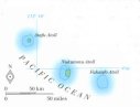
| location: Pacific Ocean |
| time zone: -11 UT |
| surface (land) area: 10,12 sq.km = 3.9 sq.mi //; - area incl. inland waters: sq.km = sq.mi |
| geographical position in extreme co-ordinates: North/South: 8° S / East/West: 170° W |
| borders (land): none |
| borders (coastline): Pacific Ocean |
| climate: tropical oceanic |
| Government |
| independent since: not yet |
| type of government: dependent territory of New Zealand since 1926 (1948) |
| capital: none, each atoll has its own administrative centre / Fakaofo is the capital in some sources |
| administrative division: none |
| Population |
| population according to the latest census (1996): 1,507 |
| total population according to the estimate of midyear 2000: 1,458 /-; 2001: 1,000 |
| population density: 144 per sq.km = 374 per sq.mi |
| population growth: ca 0% //; - doubling time: not applicable, stable population |
| birth rate: 22 per 1000 |
| death rate: 7 per 1000 |
| fertility rate: ? children per female |
| maternal mortality: per 100,000 |
| infant mortality (1-4 years): per 1000 |
| life expectancy: years (male: ; female: ) |
| age breakdown: 0-14 years: % //; - 15-59 years: % //; - 60+ years: % |
| urbanisation: % //; - urbanisation growth: % |
| percentage of urban population in the greatest city: % |
| Ethnic composition, language, religion |
| ethnic groups: Polynesian, New Zealanders |
| languages: Tokelauan (a Polynesian language), English |
| religious affiliation: Congregational Christian Church of Samoa 67%; Roman Catholic 30% |
| Health |
| daily food intake: calories per capita |
| population with access to safe water: % |
| people per physician: |
| people per hospital bed: |
| Education, literacy |
| school enrolment: primary education 6-11 years: % |
| school enrolment: secondary education: % |
| school enrolment: tertiary education 20-24 years: % |
| adult literacy: % (male: %; female: %) |
| Economy and infrastructure |
| Economy and trade |
| currency: New Zealand dollar; Tokelau souvenir coins have also been issued |
| annual inflation rate: = $NZ |
| population below poverty line: % |
| Gross Domestic Product: USD per capita |
| GNI USD per capita //; - [ppp: ] |
| GDP growth: % |
| income: USD per capita |
| import: USD per capita //; - export: USD per capita |
| trade: USD per capita //; - or % of GDP |
| trade partners: NZ |
| human development index: //; - position of the country in the world no.: |
| female labour force: % |
| unemployment: % |
| tourism: million |
| Economic activities in agriculture, fisheries, industry, mining, services, energy |
| land use: arable land: % //; - grass land: % //; - wooded area: % //; - arid land and desert: % |
| agriculture: labour force: % //; - part of agriculture in GDP: % |
| agricultural products: coconuts, copra, pulaka, breadfruit, papayas, screw-pine, bananas; fish |
| livestock (1000's): pigs: 1 |
| fish catch: 200 metric tonnes |
| industry: labour force: % //; - part of industry in GDP: % |
| industrial products: handicrafts, fish processing (tuna cannery) |
| mining products: none |
| CO2 emission per capita: |
| services: labour force: % //; - part of services in GDP: % |
| energy use (kg per capita): |
| electricity use (per capita): |
| annual water use (per capita): |
| Traffic, communication |
| road network: ? km //; - of which paved: % //; - of which are motorways: 0 km |
| vehicles: per 1000 |
| railways: 0 km //; - railways passenger/km: - |
| navigable inland waterways: 0 km |
| ownership telephone: per 1000 |
| ownership radio receivers: 700 per 1000 |
| ownership tv-sets: per 1000 |
| newspaper circulation: per 1000 |
| persons per post office: |
| personal computers: per 1000 |
| Some physical landmarks |
| mountains: no specific details of elevations found on maps |
| lowest point: sea level |
| lakes (natural): none, or unknown |
| lakes (artificial reservoirs): none, or unknown |
| lakes (deepest): unknown |
| rivers: none, or unknown |
| canals: none, or unknown |
| waterfalls: none, or unknown |
| caves: longest system: none, or unknown / deepest: |
| islands: the group consists of 3 atolls; for details see the separate file of the administrative division |
| deserts: none |
| other natural features: |
| Additional remarks, especially on the statistical information |
| other important features: |
| apart from physical landmarks most of the above figures are changeable, in most cases they date from the 1990's |
| unless action is taken to stop global warming, Tokelau will disappear under the sea in the 21st cent. |
| primary sources used for the general information: |
| BB CA EV PW WA WB WR, and some national statistical yearbooks |
| particulars concerning population data: |
 To the page containing the population growth statistics of the country
 To the page containing historical population statistics of the islands
To the page containing urban historical population statistics
 Back to the homepage of this website: POPULATION STATISTICS
Latest modification of this page on 2004-03-10 by Jan Lahmeyer
© "populstat" site: Jan Lahmeyer