All countries of the world listed from A-Z:

or choose from the countries per continent below:


 |  |  |  |  |  |
 | PALAU[Belau] : general data of the country |
| General useful information |
| Note: some data are of constant value, while other are due to changes, fluctuations etc. |
| Nation and population |
| official name (short form): Belau ; Palau |
| country code ISO: PW //; - FIPS: PS |
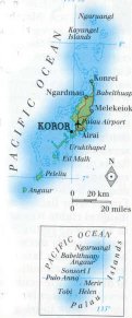
| location: Western Pacific Ocean |
| time zone: +9 UT |
| surface (land) area: 458 sq.km = 177 sq.mi //; - area incl. inland waters: sq.km = sq.mi |
| geographical position in extreme co-ordinates: North: 11° N / South: 0° N / East: 146° E / West: 131° E |
| borders (land): none |
| borders (coastline): Pacific Ocean |
| climate: tropical oceanic |
| Government |
| independent since: 1995-10-01 |
| type of government: republic as a freely associated state of the USA |
| capital: Koror |
| administrative division: state (16) |
| Population |
| population according to the latest census (2000-04): 19,129 |
| total population according to the estimate of midyear 2000: 18,766 /-; 2001: 20,000 |
| population density: 41 per sq.km = 107 per sq.mi |
| population growth: 1% //; - doubling time: ca 35 years |
| birth rate: 20 - 22 per 1000 |
| death rate: 7 - 8 per 1000 |
| fertility rate: 3 children per female |
| maternal mortality: per 100,000 |
| infant mortality (1-4 years): 25 per 1000 |
| life expectancy: 69 years (male: 66; female: 72) |
| age breakdown: 0-14 years: 30% //; - 15-59 years: 61% //; - 60+ years: 9% |
| urbanisation: 72% //; - urbanisation growth: % |
| percentage of urban population in the greatest city: % |
| Ethnic composition, language, religion |
| ethnic groups: Palauan (mixture of Polynesian, Melanesian and Malayan) 75%; Filipino 16%; Chinese 3% |
| languages: English, Palauan (both official); Sonsorolese-Tobian, Anguar, Japanese, Tobi |
| religious affiliation: Roman Catholic 37%; Protestant 26% (+Modekngei), traditional beliefs 26%; other 10% |
| Health |
| daily food intake: calories per capita |
| population with access to safe water: 100% |
| people per physician: 1500 |
| people per hospital bed: |
| Education, literacy |
| school enrolment: primary education 6-11 years: 80% |
| school enrolment: secondary education: 39% |
| school enrolment: tertiary education 20-24 years: 20% |
| adult literacy: 98% (male: %; female: %) |
| Economy and infrastructure |
| Economy and trade |
| currency: US dollar = 100 cents |
| annual inflation rate: 4% |
| population below poverty line: % |
| Gross Domestic Product: USD 5000 per capita |
| GNI USD per capita //; - [ppp: 6987] |
| GDP growth: % |
| income: USD 2500 per capita |
| import: USD 25 per capita //; - export: USD 0,5 per capita |
| trade: USD 1922 per capita //; - or % of GDP |
| trade partners: US JP |
| human development index: //; - position of the country in the world no.: |
| female labour force: 37% |
| unemployment: % |
| tourism: 0,05 million |
| Economic activities in agriculture, fisheries, industry, mining, services, energy |
| land use: arable land: % //; - grass land: % //; - wooded area: 76% //; - arid land and desert: % |
| agriculture: labour force: 7% //; - part of agriculture in GDP: 29% |
| agricultural products: fishing, fruits, vegetables, eggs, betel nuts, root crops, coconuts, copra, cassava, sweet potatoes |
| livestock (exact number of pieces, 1984!): cattle: 82 / goats: 52 / pigs: 1343 / poultry: 9500 |
| fish catch: metric tonnes |
| industry: labour force: 17% //; - part of industry in GDP: 21% |
| industrial products: small scale handicrafts |
| mining products: gold |
| CO2 emission per capita: |
| services: labour force: 76% //; - part of services in GDP: 50% |
| energy use (kg per capita): |
| electricity use (per capita): |
| annual water use (per capita): |
| Traffic, communication |
| road network: 64 km //; - of which paved: 59% //; - of which are motorways: 0 km |
| vehicles: 200 per 1000 |
| railways: 0 km //; - railways passenger/km: - |
| navigable inland waterways: 0 km |
| ownership telephone: 145 per 1000 |
| ownership radio receivers: 550 - 667 per 1000 |
| ownership tv-sets: 98 - 611 per 1000 |
| newspaper circulation: per 1000 |
| persons per post office: |
| personal computers: per 1000 |
| Some physical landmarks |
| mountains: Mount Makelulu 240 m; other unnamed peaks 225, 213, 211 m ; and Mt. Gulitel 204 m |
| lowest point: sea level |
| lakes (natural): none, or unknown |
| lakes (artificial reservoirs): none, or unknown |
| lakes (deepest): unknown |
| rivers: a few small rivers to drain the mountain slopes |
| canals: none, or unknown |
| waterfalls: none, or unknown |
| caves: longest system: none, or unknown / deepest: |
| islands: 20 islands and 350 islets and reefs, of which 8 are inhabited |
| deserts: none |
| other natural features: |
| Additional remarks, especially on the statistical information |
| other important features: |
| apart from physical landmarks most of the above figures are changeable, in most cases they date from the 1990's |
| primary sources used for the general information: |
| BB CA EV PW WA WB WR, and some national statistical yearbooks |
| particulars concerning population data: |
 To the page containing the population growth statistics of the country
 To the page containing the historical population growth statistics of the provinces
 To the page containing urban historical population statistics
 Back to the homepage of this website: POPULATION STATISTICS
Latest modification of this page on 2004-03-01 by Jan Lahmeyer
© "populstat" site: Jan Lahmeyer