All countries of the world listed from A-Z:

or choose from the countries per continent below:


 |  |  |  |  |  |
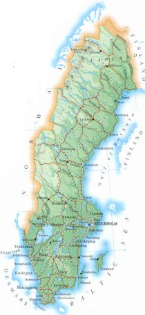 | SWEDEN[Sverige] : |
| General useful information |
| Note: some data are of constant value, while other are due to changes, fluctuations etc. |
| Nation and population |
| official name (short form): Sverige |
| country code ISO: SE //; - FIPS: SW |
| location: Northern Europe |
| time zone: +1 UT* [*= applying daylight saving time] |
| surface (land) area: 410394 sq.km = 158453 sq.mi //; - area incl. inland waters: 449964 sq.km = 173731 sq.mi |
| geographical position in extreme co-ordinates: North: 69°04' N / South: 55° 20' N / East: 24° 10' E / West: 10° 58' E |
| borders (land): Norway, Finland |
| borders (coastline): Baltic Sea, Gulf of Bothnia |
| climate: cool continental |
| Government |
| independent since: 836 ; 1397 ; 1523 ; 1905 |
| type of government: constitutional monarchy |
| capital: Stockholm |
| administrative division: län (25) |
| Population |
| population according to the latest census (1994): 8816,381 |
| total population according to the estimate of midyear 2000: 8873,052 /-; 2001: 8875,053 |
| population density: 19,7 or 21,6 per sq.km = 51, or 56 per sq.mi |
| population growth: 0,5% //; - doubling time: not applicable, exceeds 100 years |
| birth rate: 9,9 - 11, 7 per 1000 |
| death rate: 10,6 per 1000 |
| fertility rate: 2 children per female |
| maternal mortality: 5 per 100,000 |
| infant mortality (1-4 years): 6 per 1000 |
| life expectancy: 80 years (male: 77; female: 82) |
| age breakdown: 0-14 years: 22% //; - 15-59 years: 56% //; - 60+ years: 22% |
| urbanisation: 83% //; - urbanisation growth: 1% |
| percentage of urban population in the greatest city: 15% |
| Ethnic composition, language, religion |
| ethnic groups: Swedish 89,3%; Finn & Sami (Lapp) 3%; Yugoslav 0,8%; Iranian 0,6%; other 6,3% |
| languages: Swedish |
| religious affiliation: Evangelical Lutheran 94%; Roman Catholic 2%; Pentecostal 1%; other 3% |
| Health |
| daily food intake: 3114 calories per capita |
| population with access to safe water: 100% |
| people per physician: 380 |
| people per hospital bed: 279 |
| Education, literacy |
| school enrolment: primary education 6-11 years: 100% |
| school enrolment: secondary education: 91% |
| school enrolment: tertiary education 20-24 years: 31% |
| adult literacy: virtually 100% (male: %; female: %) |
| Economy and infrastructure |
| Economy and trade |
| currency: krona = 100 öre |
| annual inflation rate: 2% |
| population below poverty line: 7% |
| Gross Domestic Product: USD 27000 per capita |
| GNI USD 27140 per capita //; - [ppp: 23970] |
| GDP growth: 2% |
| income: USD per capita |
| import: USD 63987 per capita //; - export: USD 82881 per capita |
| trade: USD per capita //; - or 70% of GDP |
| trade partners: NO US GB DE FI DK |
| human development index: 0,936 //; - position of the country in the world no.: 4 |
| female labour force: 48% |
| unemployment: 4,7% |
| tourism: 3 million |
| Economic activities in agriculture, fisheries, industry, mining, services, energy |
| land use: arable land: 7% //; - grass land: 1,4% //; - wooded area: 68% //; - arid land and desert: ca 20% |
| agriculture: labour force: 3% //; - part of agriculture in GDP: 2,5% |
| agricultural products: cereals, cattle, sugar beets, potatoes, timber |
| livestock (million): cattle: 1,7 / pigs: 1,9 / poultry: 8 / sheep: 0,4 |
| fish catch: 351253 - 364115 metric tonnes |
| industry: labour force: 22% //; - part of industry in GDP: 27% |
| industrial products: engineering, electrical goods, vehicles, paper, wood pulp, steel, precision equipment, processed foods |
| mining products: iron ore, copper, lead, zinc, silver |
| CO2 emission per capita: 5,5 |
| services: labour force: 68% //; - part of services in GDP: 70% |
| energy use (kg per capita): 5769 |
| electricity use (per capita): 14138 |
| annual water use (per capita): 356 |
| Traffic, communication |
| road network: 133673 km //; - of which paved: 79% //; - of which are motorways: 1439 km |
| vehicles: 419 per 1000 |
| railways: 10853, or: 11202 km //; - railways passenger/km: 6344 |
| navigable inland waterways: 2052 km |
| ownership telephone: 655 - 681 per 1000 |
| ownership radio receivers: 844 - 933 per 1000 |
| ownership tv-sets: 476 - 531 per 1000 |
| newspaper circulation: 515 per 1000 |
| persons per post office: 5060 |
| personal computers: 507 per 1000 |
| Some physical landmarks |
| mountains: Kebnekaise 2111 m, Sarektjäkkå 2089, Kaskasajåkkå 2076, Akavare 2013, Sulitjelma 1914 |
| lowest point: sea level |
| lakes (natural): Vänern 5585 sq.km, Vättern 1912, Mälaren 1140, Hjälmaren 484, Storsjön 456, Siljan + Insjön, Orsasjön 354 |
| lakes (artificial reservoirs): none ?, or unknown |
| lakes (deepest): unknown |
| rivers: Klarälven-Göta älv 720 km, Dalälven 555, Torne älv 510, Umeälven 460, Luleälven 450, Ångermanälven 450 |
| canals: Göta kanal, Hjälmare kanal |
| waterfalls: Njupeskär 125 m, Handölsfallen 120 |
| caves: longest system: none ?, or unknown / deepest: |
| islands: Gotland 2994 sq.km, Öland 1347, Orust 346 |
| deserts: none |
| other natural features: |
| Additional remarks, especially on the statistical information |
| other important features: |
| apart from physical landmarks most of the above figures are changeable, in most cases they date from the 1990's |
| primary sources used for the general information: |
| BB CA EV PW WA WB WR, and some national statistical yearbooks |
| particulars concerning population data: |
 To the page containing the population growth statistics of the country
 To the page containing the historical population growth statistics of the provinces
 To the page containing urban historical population statistics
 Back to the homepage of this website: POPULATION STATISTICS
Internet website:Latest modification of this page on 2004-03-08 by Jan Lahmeyer
© "populstat" site: Jan Lahmeyer