All countries of the world listed from A-Z:

or choose from the countries per continent below:


 |  |  |  |  |  |
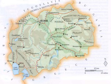 | MACEDONIAFormer Yugoslav Republic of Macedonia (FYROM) ; |
| General useful information |
| Note: some data are of constant value, while other are due to changes, fluctuations etc. |
| Nation and population |
| official name (short form): Makedonija |
| country code ISO: MK //; - FIPS: MK |
| location: Southeast Europe |
| time zone: +1 UT* [*= applying daylight saving time] |
| surface (land) area: 25713 sq.km = 9928 sq.mi //; - area incl. inland waters: sq.km = sq.mi |
| geographical position in extreme co-ordinates: North: 42°22'21" N / South: 40°51'16" N / East: 41°42'33" E / West: 41°31'04" E |
| borders (land): Albania 191 km, Bulgaria 165, Greece 262, Serbia 232 / length in km: total 850 (mainland 786, fluvial 16, lake 48) |
| borders (coastline): no sea coast boundaries; the lakes of Ohrid & Prespa form boundaries |
| climate: continental with Mediterranean-mountainous influence |
| Government |
| independent since: 1991-09-17 (national day 09-08) |
| type of government: republic |
| capital: Skopje |
| administrative division: in this state there is apparently no higher level than municipality (30) yet |
| Population |
| population according to the latest census (1994): 1936,877 /- or: 1945,932 |
| total population according to the estimate of midyear 2000: 2041,467; or: 2031,000 / -; 2001: 2038,000 |
| population density: 79 per sq.km = 205 per sq.mi |
| population growth: 5% //; - doubling time: 75 years |
| birth rate: 14 - 17 per 1000 |
| death rate: 7 - 8 per 1000 |
| fertility rate: children per female |
| maternal mortality: . per 100,000 |
| infant mortality (1-4 years): 13 - 23 per 1000 |
| life expectancy: 70 - 74 years (male: 68 - 72; female: 72 - 76) |
| age breakdown: 0-14 years: 25% //; - 15-59 years: 62% //; - 60+ years: 13% |
| urbanisation: 62% //; - urbanisation growth: 1,5% |
| percentage of urban population in the greatest city: % |
| Ethnic composition, language, religion |
| ethnic groups: Macedonian 66,6%; Albanian 22,7%; Turkish 4%; Muslim 2,3%; Roma (Gypsy) 2,2%; Serb 2,1% |
| languages: Macedonian 70% (official); Albanian 21%, Turkish, Serbo-Croatian |
| religious affiliation: Eastern Orthodox 54%; Muslim 30%; Roman Catholic 13%; Jewish |
| Health |
| daily food intake: 2938 calories per capita |
| population with access to safe water: 99% |
| people per physician: 437 |
| people per hospital bed: |
| Education, literacy |
| school enrolment: primary education 6-11 years: 73% |
| school enrolment: secondary education: 21% |
| school enrolment: tertiary education 20-24 years: 5% |
| adult literacy: 89 - 95% (male: %; female: %) |
| Economy and infrastructure |
| Economy and trade |
| currency: Denar = 100 deni |
| annual inflation rate: 79% |
| population below poverty line: % |
| Gross Domestic Product: USD 853 - 1290 per capita |
| GNI USD 1820 per capita //; - [ppp: 5020] |
| GDP growth: -1,5% |
| income: USD 3100 per capita |
| import: USD 1484 per capita //; - export: USD 1086 per capita |
| trade: USD 800 per capita //; - or 100% of GDP |
| trade partners: YU, GR, BG, TR |
| human development index: 0,766 //; - position of the country in the world no.: 60 |
| female labour force: 41% |
| unemployment: 32% |
| tourism: 0,2 million |
| Economic activities in agriculture, fisheries, industry, mining, services, energy |
| land use: arable land: 16% //; - grass land: 26% //; - wooded area: 37% //; - arid land and desert: % |
| agriculture: labour force: 8% //; - part of agriculture in GDP: 13 - 17% |
| agricultural products: wheat, grapes, corn, potatoes, plums, rice, cotton, tobacco |
| livestock (1000s): cattle: 280-295 / horses: 60 / pigs: 192-200 / poultry: 3000-3361 / sheep: 1400-1814 |
| fish catch: 135 metric tonnes |
| industry: labour force: 44% //; - part of industry in GDP: 32 - 60% |
| industrial products: cement, steel, cotton, leather, textiles |
| mining products: coal, copper, bauxite, iron, antimony, chromium, lead, zinc |
| CO2 emission per capita: 6,1 |
| services: labour force: 48% //; - part of services in GDP: 23 - 55% |
| energy use (kg per capita): 3000 |
| electricity use (per capita): |
| annual water use (per capita): |
| Traffic, communication |
| road network: 8532, or: 13900 km //; - of which paved: 64% //; - of which are motorways: 0 km |
| vehicles: 113 per 1000 |
| railways: 699, 922, or: 1150 km //; - railways passenger/km: 65 (?) |
| navigable inland waterways: 0 km |
| ownership telephone: 179 - 234 per 1000 |
| ownership radio receivers: 179 per 1000 |
| ownership tv-sets: 179 - 250 per 1000 |
| newspaper circulation: 21 per 1000 |
| persons per post office: |
| personal computers: per 1000 |
| Some physical landmarks |
| mountains: Golem Korab 2764 m, Titov Vrh 2748, Tur'cin 2702, Bristavec 2675, Rudoka 2629, Crni Breg 2610, Ezerska 'Cuka 2604, Pelister 2600 |
| lowest point: Vardar River, near border with Greece: 50 m |
| lakes (natural): Ohridsko Ezero 349 sq.km, Prespa 274, Dojran 43, Tikves 14, Debar-Globo'cica 13, Mavrovo 12 |
| lakes (artificial reservoirs): unknown |
| lakes (deepest): unknown |
| rivers: Vardar, P`cinja, Crni Drim, Strumica, Treska, Bregalnica, Crna Reka |
| canals: none |
| waterfalls: none, or unknown |
| caves: longest system: none, or unknown / deepest: |
| islands: none |
| deserts: none |
| other natural features: |
| Additional remarks, especially on the statistical information |
| other important features: |
| apart from physical landmarks most of the above figures are changeable, in most cases they date from the 1990's |
| some data are not recent, very reliable, nor available; due to the dissolution of Yugoslavia in 1991 |
| primary sources used for the general information: |
| BB CA EV PW WA WB WR, and some national statistical yearbooks |
| particulars concerning population data: |
 To the page containing the population growth statistics of the country
 To the page containing urban historical population statistics
 Back to the homepage of this website: POPULATION STATISTICS
Internet website:Latest modification of this page on 2004-02-23 by Jan Lahmeyer
© "populstat" site: Jan Lahmeyer