All countries of the world listed from A-Z:

or choose from the countries per continent below:


 |  |  |  |  |  |
 | ALBANIA[Shqipëria]general data of the country |
| General useful information |
| Note: some data are of constant value, while other are due to changes, fluctuations etc. |
| Nation and population |
| official name (short form): Shqipëria ; Shqipërisë |
| country code ISO: AL [ALB] //; - FIPS: AL |
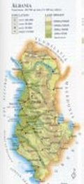
| location: Southeastern Europe |
| surface (land area): 28748 sq.km = 11100 sq.mi |
| time zone: +1 UT* [*= applying daylight saving time] |
| geographical position in extreme co-ordinates: North: 43° N / South: 40° N / East: 21° E / West: 19° E |
| borders (land): Montenegro, Serbia, Kosovo, Macedonia, Greece |
| borders (coastline): Adriatic Sea |
| climate: Mediterranean, cooler in mountainous regions |
| Government |
| independent since: 1912-11-28 |
| type of government: republic |
| capital: Tiranë (Tirana) |
| administrative division: province (26) ; recently: district (36) |
| Population |
| population according to the last two censuses (1989): 3128,417; (2001): 3087,159 |
| total population according to the estimate of midyear 2000: 3490,435; or: 3411,000; 2002: 3150,000 |
| population density: 121 per sq.km = 314 per sq.mi |
| population growth: 1,5% //; - doubling time 47 years |
| birth rate: 22 per 1000 |
| death rate: 8 per 1000 |
| fertility rate: 3 children per female |
| maternal mortality: 30-47 per 100,000 |
| infant mortality (in the first year of life): 24 per 1000 |
| infant mortality (from 1st - 4th year of life): 22 - 51 per 1000 |
| life expectancy: 69-74 year (male: 65-72; female: 72-77) |
| age groups: 0-14 years: 42% [PG: 33%] //; - 15-59 years: 53% [PG: 59%] //; - 60+ years : 8% |
| urbanisation: 37% [43%] //; - urbanisation growth: 3,4% |
| percentage of urban population in the greatest city: 25% |
| Ethnic composition, language, religion |
| ethnic groups: Albanian 98% (Gegs in the North, Tosks in the South), Greek 1,8%, Macedonian 0,1%, Montenegrin, Gypsy |
| languages: Albanian (Tosk is the official dialect), Greek, Macedonian |
| religious affiliation: Muslim (Sunnî) 65%; Albanian Orthodox 20% [23]; Christian (Roman Catholic) 13% [10] |
| Health |
| daily food intake: 2976 calories per capita |
| population with access to safe water: 76-97% |
| people per physician: 668 - 752 |
| people per hospital bed: 333 |
| Education, literacy |
| school enrolment: primary education 6-11 years: 66% |
| school enrolment: secondary education: 29% |
| school enrolment: tertiary education 20-24 years: 6% |
| adult literacy: 92% (male: 96%; female: 88%) [PG: 85%] |
| Economy and infrastructure |
| Economy and trade |
| currency: Lek = 100 qindar (qindarka) |
| annual inflation rate: 34-39% |
| population below poverty line: 19,6% |
| Gross Domestic Product: USD 360 per capita |
| GNI USD 1120-1450 per capita //; - [ppp: 3600-4960] |
| GDP growth: 2,7% |
| income: USD 1000 per capita |
| import: USD 600 per capita //; - export: USD 140 per capita |
| trade: 73 per capita //; - or 36% of GDP |
| trade partners: IT GR BG DE TR US YU CN RU UA GB |
| human development index: 0,725 //; - position of the country in the world no.: 85 |
| female labour force: 41% |
| unemployment: 18% [unofficial 30%] |
| tourism: 0,04 million |
| Economic activities in agriculture, fisheries, industry, mining, services, energy |
| land use: arable land: 26% //; - grass land: 15% //; - wooded area: 38% //; - arid land and desert: % |
| agriculture: labour force: 56% [later figure found: 71%] //; - part of agriculture in GDP: 33% [later figure found: 25-37%] |
| agricultural products: cereals, vegetables, potatoes, sugar beets, fruit, grapes, olives, cattle |
| livestock (million): asses: 0,14 / cattle: 0,84 / goats: 1,65 / pigs 0,1 / poultry: 4,3 / sheep: 2,5 |
| fish catch: 2745 - 3627 metric tonnes |
| industry: labour force: 26% [PG: 19%] //; - part of industry in GDP: 51% [later figure found: 18-19%] |
| industrial products: food products, textiles, clothing, tobacco, leather |
| mining products: chromium ore, copper ore, coal, crude petroleum, natural gas, nickel |
| CO2 emission per capita: 0,5 |
| services: labour force: 18% [PG: 25%] //; - part of services in GDP: 36% [later figure found: 46-56%] |
| energy use (kg per capita): 311 |
| electricity use (per capita): 783 |
| annual water use (per capita): 94 |
| Traffic, communication |
| road network: 15500, or 18000 km //; - of which paved: 39% //; - of which are motorways: 0 km |
| vehicles: 140,000 (or 37 per 1000 persons) // international license plate: AL |
| railways: 440, 684, or 720 km //; - railways passenger/km: 223 million |
| navigable inland waterways: 43, or 74 km |
| ownership telephone: 36 - 50 per 1000 // international dialling code: +355 |
| ownership radio receivers: 217 per 1000 |
| ownership tv -sets: 109 per 1000 |
| newspaper circulation: 54 per 1000 |
| persons per post office: 4600 |
| personal computers: 6,4 per 1000 |
| Some physical landmarks |
| mountains: Korabi 2751 m, Maja e Jerzercës 2694, Maja i Radohinës 2570, Maja e Hekuravës 2561, Gramozi 2523 |
| lowest point: sea level |
| lakes (natural): Shkodra 368 sq.km, Pogradec [=Ohrid] 363, Prespa 285 |
| lakes (artificial reservoirs): Liqeni i Fierzës 73, Vau i Dejes 25, Ulza, Liqeni i Komanit |
| lakes (deepest): unknown |
| rivers (km in Albania): Drin 285, Seman 281, Vjosë 272, Shkubin 181, Mat 115, Erzen 109, Devoll, Osum, Drinos |
| canals: none, or unknown |
| waterfalls: none, or unknown |
| caves: longest system: none, or unknown / deepest: |
| islands: Sazan |
| deserts: none |
| other natural features: |
| Additional remarks, especially on the statistical information |
| other important features: |
| apart from physical landmarks most of the above figures are changeable, in most cases they date from the 1990's |
| primary sources used for the general information: |
| BB CA EV FW PW WA WB WR, and some - local national or international - statistical yearbooks |
| particulars concerning population data: |
| in 1996 some 500,000 people were working abroad |
 To the page containing the population growth statistics of the country
 To the page containing the historical population growth statistics of the provinces
 To the page containing urban historical population statistics
 Back to the homepage of this website: POPULATION STATISTICS
Internet website: Internet website: Internet website:Latest modification of this page on 2004-12-20 by Jan Lahmeyer
© "Populstat" website: Jan Lahmeyer