All countries of the world listed from A-Z:

or choose from the countries per continent below:


 |  |  |  |  |  |
 | SINGAPOREgeneral data of the country |
| General useful information |
| Note: some data are of constant value, while other are due to changes, fluctuations etc. |
| Nation and population |
| official name (short form): Singapore ; Singapur ; Singapura ; Xinjiapo |
| country code ISO: SG //; - FIPS: SN |
| location: Southeast Asia |
| time zone: +8 UT |
| surface (land) area: 647,5 sq.km = 250 sq.mi //; - area incl. inland waters: sq.km = sq.mi |
| geographical position in extreme co-ordinates: North: / South: / East: / West: |
| borders (land): close to Malaysia |
| borders (coastline): Strait of Singapore (South China Sea) |
| climate: tropical humid |
| Government |
| independent since: 1965-08-09 |
| type of government: republic |
| capital: Singapore (- City) |
| administrative division: none, or unknown |
| Population |
| population according to the last two censuses: (1990) 2705,115 /-; (2000) 3263,209 |
| total population according to the estimate of midyear 2000: 3151,264; or: 4018,000 /-; 2001: 3306,000 |
| population density: 5096 per sq.km = 13200 per sq.mi |
| population growth: 1,5% //; - doubling time: 63 years |
| birth rate: 13 - 16 per 1000 |
| death rate: 4 - 5 per 1000 |
| fertility rate: 2 children per female |
| maternal mortality: 5 per 100,000 |
| infant mortality (1-4 years): 4 per 1000 |
| life expectancy: 80 years (male: 77; female: 83) |
| age breakdown: 0-14 years: 23% //; - 15-59 years: 68% //; - 60+ years: 9% |
| urbanisation: 100% //; - urbanisation growth: -% |
| percentage of urban population in the greatest city: 100% |
| Ethnic composition, language, religion |
| ethnic groups: Chinese 77%; Malay 14%; Indian (incl. Srilankan) 7%; other 1% |
| languages: Chinese, Malay, Tamil, English (all official) |
| religious affiliation: Buddhist 28%; Muslim 15%; Christian 13%; Taoist 13%; Hindu 4%; other (non religious included) 27% |
| Health |
| daily food intake: calories per capita |
| population with access to safe water: 100% |
| people per physician: 720 |
| people per hospital bed: 274 |
| Education, literacy |
| school enrolment: primary education 6-11 years: 100% |
| school enrolment: secondary education: 59% |
| school enrolment: tertiary education 20-24 years: 9% |
| adult literacy: 92% (male: 96%; female: 86%) |
| Economy and infrastructure |
| Economy and trade |
| currency: Singapore dollar = 100 cents |
| annual inflation rate: 1% |
| population below poverty line: % |
| Gross Domestic Product: USD 23360 per capita |
| GNI USD 24740 per capita //; - [ppp: 24910] |
| GDP growth: 5% |
| income: USD 12890 per capita |
| import: USD 131480 per capita //; - export: USD 125153 per capita |
| trade: USD 48275 per capita //; - or 295% of GDP |
| trade partners: JP US MY SA EU TH |
| human development index: 0,876 //; - position of the country in the world no.: 26 |
| female labour force: 40% |
| unemployment: 3,5% |
| tourism: 7 million |
| Economic activities in agriculture, fisheries, industry, mining, services, energy |
| land use: arable land: 1% //; - grass land: 0% //; - wooded area: 4,5% //; - arid land and desert: % ; built-up area ca 90% |
| agriculture: labour force: 1% //; - part of agriculture in GDP: <1% |
| agricultural products: fish, copra, rubber, fruit, vegetables |
| livestock (1000s): cattle: 0,2 / goats: 0,3 / pigs: 190 / poultry: 2000 |
| fish catch: 5050 - 13338 metric tonnes |
| industry: labour force: 29% //; - part of industry in GDP: 38% |
| industrial products: machinery, chemicals, transport equipment, oil refining, electronics, food & rubber processing, biotechnology |
| mining products: granite |
| CO2 emission per capita: 21,0 |
| services: labour force: 71% //; - part of services in GDP: 62% |
| energy use (kg per capita): 5742 |
| electricity use (per capita): 6641 |
| annual water use (per capita): 84 |
| Traffic, communication |
| road network: 2810, or 3150km //; - of which paved: 100% //; - of which are motorways: 150 km |
| vehicles: 105 per 1000 |
| railways: 25, or 83 km //; - railways passenger/km: |
| navigable inland waterways: 0 km |
| ownership telephone: 478 - 593 per 1000 |
| ownership radio receivers: 260 - 822 per 1000 |
| ownership tv-sets: 218 - 348 per 1000 |
| newspaper circulation: 340 per 1000 |
| persons per post office: 2570 |
| personal computers: 483 per 1000 |
| Some physical landmarks |
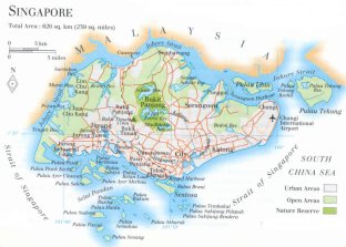
| mountains: Bukit Timah 176 m (or 162?), Bukit Gombak 133, Bukit Batok 106, Mt. Faber 105 |
| lowest point: sea level |
| lakes (natural): none, or unknown |
| lakes (artificial reservoirs): a few small ones |
| lakes (deepest): unknown |
| rivers: Kallang |
| canals: none, or unknown |
| waterfalls: none, or unknown |
| caves: longest system: / deepest: |
| islands: Palua Tekong, Palau Ubin, Sentosa and numerous smaller islands |
| deserts: none |
| other natural features: |
| Additional remarks, especially on the statistical information |
| other important features: |
| apart from physical landmarks most of the above figures are changeable, in most cases they date from the 1990's |
| Singapore was founded in 1819 by Raffles, it was a British colony until 1959 |
| primary sources used for the general information: |
| BB CA EV PW WA WB WR, and some national statistical yearbooks |
| particulars concerning population data: |
 To the page containing the population growth statistics of the country
 To the page containing urban historical population statistics
 Back to the homepage of this website: POPULATION STATISTICS
Internet website:Latest modification of this page on 2004-03-06 by Jan Lahmeyer
© "populstat" site: Jan Lahmeyer