All countries of the world listed from A-Z:

or choose from the countries per continent below:


 |  |  |  |  |  |
 | MALAYSIAgeneral data of the country |
| General useful information |
| Note: some data are of constant value, while other are due to changes, fluctuations etc. |
| Nation and population |
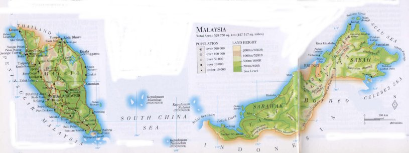
| official name (short form): Malaysia |
| country code ISO: MY //; - FIPS: MY |
| location: Southeast Asia |
| time zone: +8 UT |
| surface (land) area: 329758 sq.km = 127320 sq.mi //; - area incl. inland waters: sq.km = sq.mi |
| geographical position in extreme co-ordinates: North: 8° N / South: 1° N / East: 120° E / West: 98° E |
| borders (land): Thailand, Indonesia |
| borders (coastline): South China Sea, Indian Ocean, Sulu Sea |
| climate: tropical |
| Government |
| independent since: 1957-08-31 ; 1965 |
| type of government: constitutional monarchy |
| capital: Kuala Lumpur |
| administrative division: state (13) + federal territory (2) |
| Population |
| population according to the last two censuses: (1991): 17566,982 / -; (2001): 23274,690 |
| total population according to the estimate of midyear 2000: 21793,293; or: 23270,000 / -; 2001: 23834,000 |
| population density: 71 per sq.km = 183 per sq.mi |
| population growth: 2,5% //; - doubling time: 33 years |
| birth rate: 24 - 26 per 1000 |
| death rate: 5 per 1000 |
| fertility rate: 4 children per female |
| maternal mortality: 59 per 100,000 |
| infant mortality (1-4 years): 12 per 1000 |
| life expectancy: 72 years (male: 68; female: 74) |
| age breakdown: 0-14 years: 38% //; - 15-59 years: 56% //; - 60+ years: 6% |
| urbanisation: 62% //; - urbanisation growth: 3% |
| percentage of urban population in the greatest city: 27% |
| Ethnic composition, language, religion |
| ethnic groups: Malay 65% (including Bumiputera 12%); Chinese 26%; Indian 8%; other 2% |
| languages: Malay (official); Chinese, Tamil, Iban, Dusan, English |
| religious affiliation: Sunnî Muslim 53%; Buddhist 17%; Chinese faiths 12%; Hindu 7%; Christian 6%; other 5% |
| Health |
| daily food intake: 2901 calories per capita |
| population with access to safe water: 89% |
| people per physician: 1521 |
| people per hospital bed: 506 |
| Education, literacy |
| school enrolment: primary education 6-11 years: 100% |
| school enrolment: secondary education: 57% |
| school enrolment: tertiary education 20-24 years: 7% |
| adult literacy: 83% (male: 89%; female: 78%) |
| Economy and infrastructure |
| Economy and trade |
| currency: Ringgit = 100 cents |
| annual inflation rate: 4% |
| population below poverty line: 16% |
| Gross Domestic Product: USD 8140 per capita |
| GNI USD 3380 per capita //; - [ppp: 8330] |
| GDP growth: 4% |
| income: USD 2490 per capita |
| import: USD 77292 per capita //; - export: USD 74120 per capita |
| trade: USD 3877 per capita //; - or 201% of GDP |
| trade partners: SG US JP KR GB |
| human development index: 0,774 //; - position of the country in the world no.: 56 |
| female labour force: 38% |
| unemployment: 3% |
| tourism: 10,2 million |
| Economic activities in agriculture, fisheries, industry, mining, services, energy |
| land use: arable land: 15% //; - grass land: 1% //; - wooded area: 59% //; - arid land and desert: % |
| agriculture: labour force: 42% //; - part of agriculture in GDP: 23% |
| agricultural products: fishing, palm oil, rice, sugarcane, rubber, bananas, pineapples, cocoa beans |
| livestock (million): buffaloes: 0,2 / cattle: 0,7 / goats: 0,2 / pigs: 1,8 / poultry: 120 / sheep: 0,18 |
| fish catch: 1280000 metric tonnes |
| industry: labour force: 19% //; - part of industry in GDP: 42% |
| industrial products: electronic components, timber, crude petroleum, steel sheets, rubber goods |
| mining products: tin, kaolin, bauxite, iron ore, copper, natural oil & gas |
| CO2 emission per capita: 5,4 |
| services: labour force: 39% //; - part of services in GDP: 35% |
| energy use (kg per capita): 1878 |
| electricity use (per capita): 2474 |
| annual water use (per capita): 768 |
| Traffic, communication |
| road network: 40174, or 93975 km //; - of which paved: 76% //; - of which are motorways: 0 km |
| vehicles: 99 per 1000 |
| railways: 1791, or 2227 km //; - railways passenger/km: 1284, or 1848 |
| navigable inland waterways: 3209, or 7296 km |
| ownership telephone: 166 - 203 per 1000 |
| ownership radio receivers: 420 - 476 per 1000 |
| ownership tv-sets: 174 - 424 per 1000 |
| newspaper circulation: 142 per 1000 |
| persons per post office: 14000 |
| personal computers: 103 per 1000 |
| Some physical landmarks |
| mountains: Kinabalu 4094 m, Trus Madi 2597, Mulu 2377, Tahan 2190, Korbu 2184, Chamah 2170 |
| lowest point: sea level |
| lakes (natural): Tasek Kenyir, Temingui, Tasek Bera |
| lakes (artificial reservoirs): unknown |
| lakes (deepest): unknown |
| rivers: Kelantan, Pahang, Rajang, Baram |
| canals: unknown |
| waterfalls: unknown |
| caves: longest system: unknown / deepest: |
| islands: Pinang, Langkawi, Tioman, Labuan, Banggi, Beruit |
| deserts: none |
| other natural features: |
| Additional remarks, especially on the statistical information |
| other important features: |
| apart from physical landmarks most of the above figures are changeable, in most cases they date from the 1990's |
| primary sources used for the general information: |
| BB CA EV PW WA WB WR, and some national statistical yearbooks |
| particulars concerning population data: |
 To the page containing the population growth statistics of the country
 To the page containing the historical population growth statistics of the provinces
 To the page containing urban historical population statistics
 Back to the homepage of this website: POPULATION STATISTICS
Internet website:Latest modification of this page on 2004-02-24 by Jan Lahmeyer
© "populstat" site: Jan Lahmeyer