All countries of the world listed from A-Z:

or choose from the countries per continent below:


 |  |  |  |  |  |
 | AFGHANISTANgeneral data of the country |
| General useful information |
| Note: some data are of constant value, while other are due to changes, fluctuations etc. |
| Nation and population |
| official name (short form): Afgânistân ; Afghânestân ; Afqânestân |
| country code ISO: AF [AFG] //; - FIPS: AF |
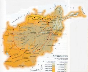
| location: SW Asia, NW of the Indian subcontinent |
| time zone: +4:30 UT |
| surface (land area): 652225 sq.km = 251825 sq.mi |
| geographical position in extreme co-ordinates: North: 39° N / South: 29° N / East: 75° E / West: 61° E |
| borders (land): Turkmenistan, Uzbekistan, Tajikistan, China, India, Pakistan, Iran |
| borders (coastline): none |
| climate: arid, harsh continental |
| Government |
| independent since: 1919-08-08 |
| type of government: republic (from 1989-2002 fundamental Islamic state) |
| capital: Kâbol (Kabul) |
| administrative division: region (8) ; province (32) |
| Population |
| population according to the latest census (1979): 13051,358 |
| total population according to the estimate of midyear 2000: 25838,797; or: 26550,000 // 2002: 27997,000 |
| population density: 43 per sq.km = 111 per sq.mi |
| population growth: 2,4% //; - doubling time: 24 years |
| birth rate: 43 per 1000 |
| death rate: 19 per 1000 |
| fertility rate: 7 children per female |
| maternal mortality: 257-690 per 100,000 |
| infant mortality (in the first year of life): 257 per 1000 |
| infant mortality (from 1st - 4th year of life): 144 - 165 per 1000 |
| life expectancy: 46 year (male: 46; female: 45) |
| age groups: 0-14 years: 44% //; - 15-59 years: 51% //; - 60+ years : 5% |
| urbanisation: 22% //; - urbanisation growth: 6% |
| percentage of urban population in the greatest city: 17% |
| Ethnic composition, language, religion |
| ethnic groups: Pashtun 38%, Tajik 25%, Hazara 19%, Uzbek 6%, Turkmen 2%, Chahar Aimak, Nuristani, Balochî, a.o. |
| languages: Pashtu, Dari (=Farsi) among which: Hazara, Tajik, Uzbek, Turkmen |
| religious affiliation: Sunnî Muslim 84%; Shî'î Muslim 15%; other 1% |
| Health |
| daily food intake: calories per capita |
| population with access to safe water: 13% |
| people per physician: 9090 |
| people per hospital bed: 2945 |
| Education, literacy |
| school enrolment: primary education 6-11 years: 22% |
| school enrolment: secondary education: 7% |
| school enrolment: tertiary education 20-24 years: 1% |
| adult literacy: 37% [PG: 29%] (male: 51%; female: 21%) |
| Economy and infrastructure |
| Economy and trade |
| currency: 1 Afghani (Af) = 100 puls [puli] |
| annual inflation rate: 14% [57%] |
| population below poverty line: % |
| Gross Domestic Product: 280 USD per capita |
| GNI USD per capita //; - [ppp: ] |
| GDP growth: 6?% |
| income: 300 - 450 USD per capita |
| import: USD 600 per capita //; - export: 200 USD per capita |
| trade: 48 - 73 USD per capita //; - or % of GDP |
| trade partners: RU JP SG CH BE PK IN DE GB US KR FI |
| human development index: //; - position of the country in the world no.: |
| female labour force: 36% |
| unemployment: 8% |
| tourism: 0,004 million |
| Economic activities in agriculture, fisheries, industry, mining, services, energy |
| land use: arable land: 12,5% //; - grass land: 46% //; - wooded area: 4% //; - arid land and desert: 35% |
| agriculture: labour force: 67% [PG: 61%] //; - part of agriculture in GDP: 52% |
| agricultural products: dried fruits and nuts, carpets, rugs, cotton, karakul wool and hides |
| livestock (million): asses: / camels: 0,3 / cattle: 1,5 / goats: 5 / horses: 0,3 / poultry: 7 / sheep: 11-14 |
| fish catch: 1200 metric tonnes |
| industry: labour force: 6% [PG: 14%] //; - part of industry in GDP: 33% |
| industrial products: food products, leather and fur products, textiles |
| mining products: salt, copper, gypsum, barite, natural gas, coal, talc, lapislazuli |
| CO2 emission per capita: 0,0 |
| services: labour force: 27% [PG: 25%] //; - part of services in GDP: 15% |
| energy use (kg per capita): 27?; 745? |
| electricity use (per capita): 38 |
| annual water use (per capita): 1830 |
| Traffic, communication |
| road network: 21000 km //; - of which paved: 13,3% //; - of which are motorways: 0 km |
| vehicles: 2 per 1000 // international license plate: AFG |
| railways: 25 km //; - railways passenger/km: ? |
| navigable inland waterways: 1200 km |
| ownership telephone: 1 per 1000 // international dialling code: +93 |
| ownership radio receivers: 132 per 1000 |
| ownership tv -: 12 per 1000 |
| newspaper circulation: 11 per 1000 |
| persons per post office: 61300 |
| personal computers: ? per 1000 |
| Some physical landmarks |
| mountains: Istoro Nal 7455 m, Sad Istragh 7037, Shah Fuladi 5143, Sikaram 4760, Koh-i-Qaisar 4148 |
| lowest point: Sistan 457 m in the sw corner of prov. Neemroze; and northwestern corner of prov. Jawzjan |
| lakes (natural): Hamun-e-Saberi |
| lakes (artificial reservoirs): none, or unknown |
| lakes (deepest): unknown |
| rivers: Amu Darya, Hari Rud, Helmand, Khash Rud, Farah Rud, Balkhab, Surkhab |
| canals: none, or unknown |
| waterfalls: none, or unknown |
| caves: longest system: none, or unknown / deepest: |
| islands: none |
| deserts: Rigestan (Registan) |
| other natural features: |
| Additional remarks, especially on the statistical information |
| other important features: |
| apart from physical landmarks most of the above figures are changeable, in most cases they date from the 1990's |
| most figures are unreliable estimates, due to the instable situation of this country during the 1990's |
| primary sources used for the general information: |
| BB CA EV FW PW WA WB WR, and some - local national or international - statistical yearbooks |
| particulars concerning population data: |
| recent reliable figures are not available |
 To the page containing the population growth statistics of the country
 To the page containing the historical population growth statistics of the administrative division
 To the page containing urban historical population statistics
 Back to the homepage of this website: POPULATION STATISTICS
Internet website: Internet website:Latest modification of this page on 2004-12-20 by Jan Lahmeyer
© "Populstat" website: Jan Lahmeyer