All countries of the world listed from A-Z:

or choose from the countries per continent below:


 |  |  |  |  |  |
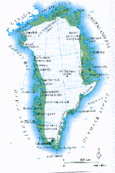 | GREENLAND[Kalaallit Nunaat] : |
| General useful information |
| Note: some data are of constant value, while other are due to changes, fluctuations etc. |
| Nation and population |
| official name (short form): Grønland ; Kalaallit Nunaat |
| country code ISO: GL //; - FIPS: GL |
| location: Northeast North America, North Atlantic Ocean |
| time zone: -3 UT* [*= applying daylight saving time] |
| surface (land) area: 2175600 sq.km = 839999 sq.mi //; - area incl. inland waters: sq.km = sq.mi |
| geographical position in extreme co-ordinates: North: 84° N / South: 60° N / East: 12° W / West: 73° W |
| borders (land): none |
| borders (coastline): Arctic Ocean, Greenland Sea, Denmark Strait, Davis Strait, Baffin Bay |
| climate: arctic |
| Government |
| independent since: not yet |
| type of government: integral part within the Danish realm since 1953 |
| capital: Nuuk (Godthåb) |
| administrative division: amt (3) into municipality (18) |
| Population |
| population according to the latest census (1996): 55,863 |
| total population according to the estimate of midyear 2000: 56,309 // - ; 2001: 55,983 |
| population density: 0,025 per sq.km = 0, 067 per sq.mi |
| population growth: 0,1% //; - doubling time: ca 60 years |
| birth rate: 22 per 1000 |
| death rate: 8 per 1000 |
| fertility rate: 2 children per female |
| maternal mortality: per 100,000 |
| infant mortality (1-4 years): 27 per 1000 |
| life expectancy: 65,5 years (male: 61; female: 68) |
| age breakdown: 0-14 years: 28% //; - 15-59 years: 64,5% //; - 60+ years: 7,5% |
| urbanisation: 81% //; - urbanisation growth: % |
| percentage of urban population in the greatest city: % |
| Ethnic composition, language, religion |
| ethnic groups: Greenlander (Inuit) 86%; Danish 14% |
| languages: Inuit dialects, Danish |
| religious affiliation: Lutheran 67%; other 33% |
| Health |
| daily food intake: calories per capita |
| population with access to safe water: % |
| people per physician: |
| people per hospital bed: |
| Education, literacy |
| school enrolment: primary education 6-11 years: % |
| school enrolment: secondary education: % |
| school enrolment: tertiary education 20-24 years: % |
| adult literacy: % (male: %; female: %) |
| Economy and infrastructure |
| Economy and trade |
| currency: Danish Kron = 100 øre |
| annual inflation rate: % |
| population below poverty line: % |
| Gross Domestic Product: USD 16650 per capita |
| GNI USD per capita //; - [ppp: ] |
| GDP growth: % |
| income: USD 6000 per capita |
| import: USD 421 per capita //; - export: USD 364 per capita |
| trade: USD per capita //; - or % of GDP |
| trade partners: DK |
| human development index: //; - position of the country in the world no.: |
| female labour force: 33% |
| unemployment: % |
| tourism: 0,2 million |
| Economic activities in agriculture, fisheries, industry, mining, services, energy |
| land use: arable land: 0% //; - grass land: 1% //; - wooded area: 0% //; - arid land and desert: % |
| agriculture: labour force: 15% //; - part of agriculture in GDP: 30% |
| agricultural products: fisheries |
| livestock (million): some sheep (22000) and reindeer (2600 - 5000), no further data available |
| fish catch: 120596 - 160253 metric tonnes |
| industry: labour force: 15% //; - part of industry in GDP: % |
| industrial products: fish canning |
| mining products: lead, zinc, uranium |
| CO2 emission per capita: 9,4 |
| services: labour force: 70% //; - part of services in GDP: % |
| energy use (kg per capita): |
| electricity use (per capita): |
| annual water use (per capita): |
| Traffic, communication |
| road network: 80 - 150 km //; - of which paved: % //; - of which are motorways: 0 km |
| vehicles: 54 per 1000 |
| railways: 0 km //; - railways passenger/km: - |
| navigable inland waterways: 0 km |
| ownership telephone: per 1000 |
| ownership radio receivers: 374 per 1000 |
| ownership tv-sets: per 1000 |
| newspaper circulation: per 1000 |
| persons per post office: 744 |
| personal computers: per 1000 |
| Some physical landmarks |
| mountains: Gunnbjørn(s) Fjeld 3700 m, Mont Forel 3360 |
| lowest point: sea level |
| lakes (natural): none |
| lakes (artificial reservoirs): none |
| lakes (deepest): unknown |
| rivers: only some very small drainage rivers of no importance or unnamed in atlantes at the dsiposal of the compiler |
| canals: none |
| waterfalls: unknown |
| caves: longest system: unknown / deepest: |
| islands: Disko (Qeqertarsuaq), Qerqertag, Jens Munks ø |
| deserts: none |
| other natural features: maximum measured ice thickness: 3270 m |
| Additional remarks, especially on the statistical information |
| other important features: |
| apart from physical landmarks most of the above figures are changeable, in most cases they date from the 1990's |
| the largest known island in the world, 84% of its land is permanently ice-capped, average thickness 300 m |
| primary sources used for the general information: |
| BB CA EV PW WA WB WR, and some national statistical yearbooks |
| particulars concerning population data: |
 To the page containing the population growth statistics of the country
 To the page containing the historical population growth statistics of the provinces
 To the page containing urban historical population statistics
 Back to the homepage of this website: POPULATION STATISTICS
Latest modification of this page on 2004-02-14 by Jan Lahmeyer
© "populstat" site: Jan Lahmeyer