All countries of the world listed from A-Z:

or choose from the countries per continent below:


 |  |  |  |  |  |
 | ECUADORgeneral data of the country |
| General useful information |
| Note: some data are of constant value, while other are due to changes, fluctuations etc. |
| Nation and population |
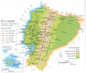
| official name (short form): Ecuador |
| country code ISO: EC //; - FIPS: EC |
| location: NW South America |
| time zone: -5 UT (Galápagos -6 UT) |
| surface (land) area: 276840 sq.km = 105037 sq.mi //; - area incl. inland waters: sq.km = sq.mi |
| geographical position in extreme co-ordinates: North: 2° N / South: 5° S / East: 75° W / West: 81° W (excluding Galápagos) |
| borders (land): Colombia, Perú |
| borders (coastline): Pacific Ocean |
| climate: tropical, which - infuenced by altitude - varies to alpine |
| Government |
| independent since: 1822-05-24 |
| type of government: republic |
| capital: Quito |
| administrative division: provincia (21); these further divided into canton (115), and comunidad (715) |
| Population |
| population according to the last two censuses: (1990): 9648,189 ; (2001): 12090,804 |
| total population according to the estimate of midyear 2000: 12920,092; or: 12646,000 |
| population density: 44 per sq.km = 113 per sq.mi |
| population growth: 2,4% //; - doubling time: 34 years |
| birth rate: 31 per 1000 |
| death rate: 6,5 per 1000 |
| fertility rate: 4 children per female |
| maternal mortality: 190 per 100,000 |
| infant mortality (1-4 years): 39 - 57 per 1000 |
| life expectancy: 71 years (male: 68; female: 74) |
| age breakdown: 0-14 years: 40% //; - 15-59 years: 55% //; - 60+ years: 6% |
| urbanisation: 64% //; - urbanisation growth: 4,5% |
| percentage of urban population in the greatest city: 29% |
| Ethnic composition, language, religion |
| ethnic groups: Mestizo 40-55%; Amerindian 25-40%; white 10-15%; black 5-10% [differences depends on source] |
| languages: Spanish ; Quechua and other Amerindian |
| religious affiliation: Roman Catholic 92,5%; Protestant 3,4%; other: 4,1% |
| Health |
| daily food intake: 2724 calories per capita |
| population with access to safe water: 70% |
| people per physician: 980 |
| people per hospital bed: |
| Education, literacy |
| school enrolment: primary education 6-11 years: 55% |
| school enrolment: secondary education: 28% |
| school enrolment: tertiary education 20-24 years: 16% |
| adult literacy: 88,3% (male: 90,5%; female: 86,2%) |
| Economy and infrastructure |
| Economy and trade |
| currency: Sucre = 100 centavos |
| annual inflation rate: 34% |
| population below poverty line: 35% |
| Gross Domestic Product: USD 1390 per capita |
| GNI USD 1210 per capita //; - [ppp: 2910] |
| GDP growth: 0% |
| income: USD 1020 per capita |
| import: USD 4195 per capita //; - export: USD 4362 per capita |
| trade: USD 474 per capita //; - or 61% of GDP |
| trade partners: US CO JP BR VE DE MX IT PE CL ES BE |
| human development index: 0,726 //; - position of the country in the world no.: 84 |
| female labour force: 28% |
| unemployment: 9% |
| tourism: 0,6 million |
| Economic activities in agriculture, fisheries, industry, mining, services, energy |
| land use: arable land: 10% //; - grass land: 19% //; - wooded area: 39% //; - arid land and desert: % |
| agriculture: labour force: 39% //; - part of agriculture in GDP: 15% |
| agricultural products: bananas, rice, maize, planains, potatoes, soybeans, cocoa, coffee, sugar, plantains |
| livestock (million): cattle: 5,1 / goats: 0,3 / horses: 0,5 / pigs: 2,8 / poultry: 136 / sheep: 1,9 |
| fish catch: 497872 metric tonnes (especially shrimp) |
| industry: labour force: 20% //; - part of industry in GDP: 35% |
| industrial products: food processing, chemical, petroleum products, metalwork, textiles |
| mining products: crude petroleum, natural gas, limestone, gold, kaolin |
| CO2 emission per capita: 2,2 |
| services: labour force: 42% //; - part of services in GDP: 50% |
| energy use (kg per capita): 705 |
| electricity use (per capita): 620 |
| annual water use (per capita): 581 |
| Traffic, communication |
| road network: 43200 km //; - of which paved: 18% //; - of which are motorways: 1397 km |
| vehicles: 46 per 1000 |
| railways: 966 km //; - railways passenger/km: 27 |
| navigable inland waterways: 1500 km |
| ownership telephone: 65 - 91 per 1000 |
| ownership radio receivers: 277 - 348 per 1000 |
| ownership tv-sets: 79 - 148 per 1000 |
| newspaper circulation: 72 per 1000 |
| persons per post office: 42900 |
| personal computers: 22 per 1000 |
| Some physical landmarks |
| mountains: Chimborazo 6310 m, Cotopaxi 5897, Atizana 5704, Iliniza 5263 |
| lowest point: sea level |
| lakes (natural): none or of little importance |
| lakes (artificial reservoirs): unknown |
| lakes (deepest): unknown |
| rivers: Daule, Napo, San Miguel |
| canals: none |
| waterfalls: Agoyan 67 m |
| caves: longest system: unknown / deepest: |
| islands: Archipiélago Colón (Galápagos), Isla Puna |
| deserts: none |
| other natural features: |
| Additional remarks, especially on the statistical information |
| other important features: |
| apart from physical landmarks most of the above figures are changeable, in most cases they date from the 1990's |
| area 1878: 643295 sq.km; afterwards 444851 sq.km; since 1942: 256074 sq.km |
| primary sources used for the general information: |
| BB CA EV PW WA WB WR, and some national statistical yearbooks |
| particulars concerning population data: |
 To the page containing the population growth statistics of the country
 To the page containing the historical population growth statistics of the provinces
 To the page containing urban historical population statistics
 Back to the homepage of this website: POPULATION STATISTICS
Internet website:Latest modification of this page on 2004-02-07 by Jan Lahmeyer
© "populstat" site: Jan Lahmeyer