All countries of the world listed from A-Z:

or choose from the countries per continent below:


 |  |  |  |  |  |
 | ARUBAgeneral data of the country |
| General useful information |
| Note: some data are of constant value, while other are due to changes, fluctuations etc. |
| Nation and population |
| official name (short form): Aruba |
| country code ISO: AW //; - FIPS: AA |
| location: in the group of the Lesser Antilles in the South Caribbean Sea, just off the coast of N South America |
| time zone: -4 UT [*= applying daylight saving time] |
| surface (land) area: 193 sq.km = 75 sq.mi //; - area incl. inland waters: sq.km = sq.mi |
| geographical position in extreme co-ordinates: North: 12° 37' N / South: 12° 24' N / East: 69° 53' W / West: 70° 04' W |
| borders (land): none; the nearest land area is Venezuela, at some 25 km or 10 miles distance |
| borders (coastline): Caribbean Sea |
| climate: tropical Caribbean |
| Government |
| independent since: 1986-01-01 |
| type of government: "status aparte" [=special status] within the Kingdom of the Netherlands (Europe) |
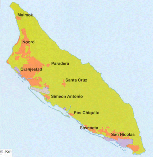
| capital: Oranjestad |
| administrative division: none [or unknown] |
| Population |
| population according to the last two censuses: (1995): 65,974 /-; (2000): 90,850 |
| total population according to the estimate of midyear 2000: 69,539 //; or: 101,000 ; 2001: 70,007 //; or: 104,000 |
| population density: per 365 per sq.km = 933 per sq.mi |
| population growth: 2% //; - doubling time: years |
| birth rate: 14-15 per 1000 |
| death rate: 6 per 1000 |
| fertility rate: 2 children per female |
| maternal mortality: per 100,000 |
| infant mortality (in the first year of life): per 1000 |
| infant mortality (from 1st - 4th year of life): 8 per 1000 |
| life expectancy: 76-77 years (male: 72-73; female: 80-81) |
| age breakdown: 0-14 years: 24% //; - 15-59 years: 66% //; - 60+ years : 10% |
| urbanisation: % //; - urbanisation growth: % |
| percentage of urban population in the greatest city: % |
| Ethnic composition, language, religion |
| ethnic groups: mixed European/Carribean Indian 80% |
| languages: Papiamento, Dutch, English, Spanish |
| religious affiliation: Roman Catholic 82%, Protestant 8% |
| Health |
| daily food intake: calories per capita |
| population with access to safe water: 100% |
| people per physician: |
| people per hospital bed: |
| Education, literacy |
| school enrolment: primary education 6-11 years: % |
| school enrolment: secondary education: % |
| school enrolment: tertiary education 20-24 years: % |
| adult literacy: 99% (male: %; female: %) |
| Economy and infrastructure |
| Economy and trade |
| currency: Aruba gulden (guilder) = 100 cents |
| annual inflation rate: % |
| population below poverty line: % |
| Gross Domestic Product: 15890 USD per capita |
| GNI USD per capita //; - [ppp: ] |
| GDP growth: 6% |
| income: USD 16000 per capita |
| import: 487 USD per capita //; - export: 37 USD per capita |
| trade: USD per capita //; - or 50% of GDP |
| trade partners: VE US NL |
| human development index: //; - position of the country in the world no.: |
| female labour force: 42% |
| unemployment: % |
| tourism: 0,7 million |
| Economic activities in agriculture, fisheries, industry, mining, services, energy |
| land use: arable land: 11% //; - grass land: % //; - wooded area: % //; - arid land and desert: % |
| agriculture: labour force: 0,5% //; - part of agriculture in GDP: % |
| agricultural products: of no importance |
| livestock (1000s): pigs: 1 / poultry: 50 / sheep: 1 |
| fish catch: 175 metric tonnes |
| industry: labour force: 17% [PG: 11%] //; - part of industry in GDP: % |
| industrial products: petrochemicals, beverages, fertilizers |
| mining products: of no importance |
| CO2 emission per capita: 20,0 |
| services: labour force: 77% [PG: 89%] //; - part of services in GDP: % |
| energy use (kg per capita): 6614 |
| electricity use (per capita): |
| annual water use (per capita): |
| Traffic, communication |
| road network: 380 km //; - of which paved: 100% //; - of which are motorways: 0 km |
| vehicles: 500 per 1000 // international license plate: ? |
| railways: 0 km //; - railways passenger/km: - |
| navigable inland waterways: 0 km |
| ownership telephone: 390 per 1000 // international dialling code: +297 |
| ownership radio receivers: 571 per 1000 |
| ownership tv-sets: 471 per 1000 |
| newspaper circulation: 757 per 1000 |
| persons per post office: 20500 |
| personal computers: per 1000 |
| Some physical landmarks |
| mountains: Jamanota 189 m, Arikok 188, Cer'i Cabai 174, Hooiberg 168, Kenepa 143 |
| lowest point: sea level |
| lakes (natural): Balashi |
| lakes (artificial reservoirs): |
| lakes (deepest): unknown |
| rivers: none of importance |
| canals: unknown |
| waterfalls: unknown |
| caves: longest system: unknown / deepest: |
| islands: none |
| deserts: none |
| other natural features: |
| Additional remarks, especially on the statistical information |
| other important features: |
| apart from physical landmarks most of the above figures are changeable, in most cases they date from the 1990's |
| primary sources used for the general information: |
| BB CA DK EV FW PW WA WB WR, and some - local national or international - statistical yearbooks |
| particulars concerning population data: |
 To the page containing the population growth statistics of the country
 To the page containing urban historical population statistics
 Back to the homepage of this website: POPULATION STATISTICS
Latest modification of this page on 2004-12-20 by Jan Lahmeyer
© "Populstat" website: Jan Lahmeyer