All countries of the world listed from A-Z:

or choose from the countries per continent below:


 |  |  |  |  |  |
 | SWAZILANDgeneral data of the country |
| General useful information |
| Note: some data are of constant value, while other are due to changes, fluctuations etc. |
| Nation and population |
| official name (short form): Swaziland, weSwatini |
| country code ISO: SZ //; - FIPS: WZ |
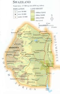
| location: Southern Africa |
| time zone: +2 UT |
| surface (land) area: 17360 sq.km = 6703 sq.mi //; - area incl. inland waters: sq.km = sq.mi |
| geographical position in extreme co-ordinates: North: 26° S / South: 28° S / East: 32° E / West: 30° E |
| borders (land): Mozambique, South Africa |
| borders (coastline): none |
| climate: temperate |
| Government |
| independent since: 1968-09-06 |
| type of government: constitutional monarchy |
| capital: Mbabane |
| administrative division: district (4) |
| Population |
| population according to the last two censuses: 1986: 681,059 /-; 1997: 965,859 |
| total population according to the estimate of midyear 2000: 1083,289 /-; 2001: 1104,343 |
| population density: 63 per sq.km = 164 per sq.mi |
| population growth: 3% //; - doubling time: 22 years |
| birth rate: 40 - 43 per 1000 |
| death rate: 11 - 22 per 1000 |
| fertility rate: 6 children per female |
| maternal mortality: per 100,000 |
| infant mortality (1-4 years): 91 per 1000 |
| life expectancy: 38 - 57 years (male: 38 - 53; female: 39 - 61) |
| age breakdown: 0-14 years: 47% //; - 15-59 years: 48% //; - 60+ years: 5% |
| urbanisation: 26 - 34% //; - urbanisation growth: % |
| percentage of urban population in the greatest city: % |
| Ethnic composition, language, religion |
| ethnic groups: Swazi 84,3%; Zulu 9,9%; Tsonga 2,5%; Indian 0,8%; Pakistani 0,8%; Portuguese 0,5% |
| languages: English, siSwati (both official) |
| religious affiliation: Protestant 37%; African indigenous 29%; Roman Catholic 11%; traditional beliefs 21% |
| Health |
| daily food intake: 2503 calories per capita |
| population with access to safe water: 43% |
| people per physician: 6663 |
| people per hospital bed: |
| Education, literacy |
| school enrolment: primary education 6-11 years: 60% |
| school enrolment: secondary education: 20% |
| school enrolment: tertiary education 20-24 years: 4% |
| adult literacy: 77% (male: %; female: %) |
| Economy and infrastructure |
| Economy and trade |
| currency: lilangeni = 100 cents |
| annual inflation rate: 13% |
| population below poverty line: 40% |
| Gross Domestic Product: USD 1160 per capita |
| GNI USD 1390 per capita //; - [ppp: 4600] |
| GDP growth: 0,2% |
| income: USD 1060 per capita |
| import: USD 963 per capita //; - export: USD 752 per capita |
| trade: USD 1300 per capita //; - or 131% of GDP |
| trade partners: ZA |
| human development index: 0,583 //; - position of the country in the world no.: 113 |
| female labour force: 38% |
| unemployment: % |
| tourism: 0,3 million |
| Economic activities in agriculture, fisheries, industry, mining, services, energy |
| land use: arable land: 12% //; - grass land: 69% //; - wooded area: 6% //; - arid land and desert: % |
| agriculture: labour force: 74% //; - part of agriculture in GDP: 23% |
| agricultural products: sugarcane, maize, grapefruit & pomelo, lint cotton, roots & tubers, rice, pineappels, tobacco, peanuts |
| livestock (1000s): cattle: 607-658 / goats: 422-440 / pigs: 32 / poultry: 990-3000 / sheep: 27 |
| fish catch: metric tonnes |
| industry: labour force: 9% //; - part of industry in GDP: 40% |
| industrial products: food processing, paper & paper products, textiles, wood products, pulp |
| mining products: asbestos, diamonds, coal, gold, cassiterite, iron, beryl |
| CO2 emission per capita: 0,4 |
| services: labour force: 17% //; - part of services in GDP: 37% |
| energy use (kg per capita): 264 |
| electricity use (per capita): |
| annual water use (per capita): 423 |
| Traffic, communication |
| road network: 2779, or 3825 km //; - of which paved: 28% //; - of which are motorways: 0 km |
| vehicles: 32 per 1000 |
| railways: 301, or 370 km //; - railways passenger/km: 1210 |
| navigable inland waterways: 0 km |
| ownership telephone: 21 - 31 per 1000 |
| ownership radio receivers: 129 - 550 per 1000 |
| ownership tv-sets: 96 - 107 per 1000 |
| newspaper circulation: 14 per 1000 |
| persons per post office: 14900 |
| personal computers: 0,3 per 1000 |
| Some physical landmarks |
| mountains: Emlembe 1862 m |
| lowest point: ca 170 m, on the Eastern border where the Lusutfu river leaves the country |
| lakes (natural): none, or unknown |
| lakes (artificial reservoirs): Jozini, Mnjoli |
| lakes (deepest): unknown |
| rivers: Komati, Mbuluzi, Lusutfu, Nggwavuma |
| canals: none, or unknown |
| waterfalls: none, or unknown |
| caves: longest system: none, or unknown / deepest: |
| islands: none |
| deserts: none |
| other natural features: |
| Additional remarks, especially on the statistical information |
| other important features: |
| apart from physical landmarks most of the above figures are changeable, in most cases they date from the 1990's |
| primary sources used for the general information: |
| BB CA EV PW WA WB WR, and some national statistical yearbooks |
| particulars concerning population data: |
 To the page containing the population growth statistics of the country
 To the page containing the historical population growth statistics of the provinces
 To the page containing urban historical population statistics
 Back to the homepage of this website: POPULATION STATISTICS
Internet website: Internet website:Latest modification of this page on 2004-03-08 by Jan Lahmeyer
© "populstat" site: Jan Lahmeyer