All countries of the world listed from A-Z:

or choose from the countries per continent below:


 |  |  |  |  |  |
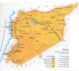 | SYRIA[Souriyya] : |
| General useful information |
| Note: some data are of constant value, while other are due to changes, fluctuations etc. |
| Nation and population |
| official name (short form): Sûrîya |
| country code ISO: SY //; - FIPS: SY |
| location: Southwest Asia, Middle East |
| time zone: +2 UT* [*= applying daylight saving time] |
| surface (land) area: 185180 sq.km = 71498 sq.mi //; - area incl. inland waters: sq.km = sq.mi |
| geographical position in extreme co-ordinates: North: 37° N / South: 32° N / East: 42° E / West: 36° E |
| borders (land): Turkey 845 km, Iraq 596, Jordan 356, Palestine 74, Lebanon 359 |
| borders (coastline): Mediterranean Sea 183 km |
| climate: Mediterrannean (coastal region), continental arid, hot |
| Government |
| independent since: 1946-04-17 |
| type of government: republic |
| capital: Es-Sham (Damascus) |
| administrative division: muhafazah [governorate] (14) |
| Population |
| population according to the latest census (1994): 13782,315 |
| total population according to the estimate of midyear 2000: 16305,659; or: 16189,000 /-; 2001: 16544,000; or: 16782,808 |
| population density: 88 per sq.km = 228 per sq.mi |
| population growth: 3,5% //; - doubling time: 21 years |
| birth rate: 31 - 40 per 1000 |
| death rate: 5 - 6 per 1000 |
| fertility rate: 6 children per female |
| maternal mortality: 280 per 100,000 |
| infant mortality (1-4 years): 30 per 1000 |
| life expectancy: 69 years (male: 67; female: 70) |
| age breakdown: 0-14 years: 48% //; - 15-59 years: 48% //; - 60+ years: 4% |
| urbanisation: 55% //; - urbanisation growth: 5% |
| percentage of urban population in the greatest city: 33% |
| Ethnic composition, language, religion |
| ethnic groups: Arab 89%; Kurdish 8%; Armenian 2% |
| languages: Arabic (official); Kurdish, Armenian, Amharic, Cherkess, Turkmen |
| religious affiliation: Sunnî Muslim 74%; other Muslim 16% (Shî'î 12%); Christian 6%; Druze 3% |
| Health |
| daily food intake: 3378 calories per capita |
| population with access to safe water: 85% |
| people per physician: 694 |
| people per hospital bed: 832 |
| Education, literacy |
| school enrolment: primary education 6-11 years: 99% |
| school enrolment: secondary education: 57% |
| school enrolment: tertiary education 20-24 years: 18% |
| adult literacy: 71% (male: 86%; female: 56%) |
| Economy and infrastructure |
| Economy and trade |
| currency: Syrian pound = 100 piasters |
| annual inflation rate: 7% |
| population below poverty line: 20% |
| Gross Domestic Product: USD 3250 per capita |
| GNI USD 940 per capita //; - [ppp: 3340] |
| GDP growth: 3% |
| income: USD 1110 per capita |
| import: USD 4709 per capita //; - export: USD 3670 per capita |
| trade: USD 502 per capita //; - or 48% of GDP |
| trade partners: CIS-countries RO DE FR IT TR US |
| human development index: 0,7 //; - position of the country in the world no.: 97 |
| female labour force: 27% |
| unemployment: % |
| tourism: 1,4 million |
| Economic activities in agriculture, fisheries, industry, mining, services, energy |
| land use: arable land: 31% //; - grass land: 43% //; - wooded area: 4% //; - arid land and desert: 20% |
| agriculture: labour force: 22% //; - part of agriculture in GDP: 30% |
| agricultural products: wheat, barley, seed cotton, tomatoes, grapes, apples, eggplants, lentils, chickpeas, wool, dairy |
| livestock (million): asses: 0,2 / cattle: 0,98 / goats: 1 / pigs: 0,7 / poultry: 22 / sheep: 13,5 |
| fish catch: 7945 metric tonnes |
| industry: labour force: 15% //; - part of industry in GDP: 23% |
| industrial products: cement, wheat flour, refined sugar, fertilizers, olive oil, textiles, soap, rugs, tobacco, oil products |
| mining products: phosphate rock, gypsum, salt, marble blocks, oil & natural gas, iron |
| CO2 emission per capita: 3,3 |
| services: labour force: 63% //; - part of services in GDP: 47% |
| energy use (kg per capita): 1143 |
| electricity use (per capita): 863 |
| annual water use (per capita): 435 |
| Traffic, communication |
| road network: 29682, or 41792 km //; - of which paved: 23, or 71% //; - of which are motorways: 712 km |
| vehicles: 9 per 1000 |
| railways: 1766, or 2450 km //; - railways passenger/km: 855 |
| navigable inland waterways: 672, or 870 km |
| ownership telephone: 63 - 99 per 1000 |
| ownership radio receivers: 207 - 278 per 1000 |
| ownership tv-sets: 49 - 89 per 1000 |
| newspaper circulation: 18 per 1000 |
| persons per post office: 21800 |
| personal computers: 15 per 1000 |
| Some physical landmarks |
| mountains: Jabal Ash-Shaykh (Mt. Hermon) 2814 m, Aten 2615, Halîmah (Halimeh) 2464, Shaquef 2462 |
| lowest point: sea level |
| lakes (natural): Sabkhat al-Jabbûl 239 sq.km; Qattineh 61 sq.km |
| lakes (artificial reservoirs): Buhayrat al-Asad 674 sq.km |
| lakes (deepest): unknown |
| rivers: Nahr al-Furat (Euphrates) 680 km, Al-Khabour 442, Orontes 441, Nahr al-'Asi, Al-Balikh 202 |
| canals: none, or unknown |
| waterfalls: none, or unknown |
| caves: longest system: none, or unknown / deepest: |
| islands: none, or unknown |
| deserts: Syrian Desert |
| other natural features: |
| Additional remarks, especially on the statistical information |
| other important features: |
| apart from physical landmarks most of the above figures are changeable, in most cases they date from the 1990's |
| primary sources used for the general information: |
| BB CA EV PW WA WB WR, and some national statistical yearbooks |
| particulars concerning population data: |
 To the page containing the population growth statistics of the country
 To the page containing the historical population growth statistics of the provinces
 To the page containing urban historical population statistics
 Back to the homepage of this website: POPULATION STATISTICS
Internet website:Latest modification of this page on 2004-03-08 by Jan Lahmeyer
© "populstat" site: Jan Lahmeyer