All countries of the world listed from A-Z:

or choose from the countries per continent below:


 |  |  |  |  |  |
 | The PHILIPPINES[Pilipinas ; Filipinas] : |
| General useful information |
| Note: some data are of constant value, while other are due to changes, fluctuations etc. |
| Nation and population |
| official name (short form): Pilipinas |
| country code ISO: PH //; - FIPS: RP |
| location: Southeast Asia |
| time zone: +8 UT |
| surface (land) area: 300076 sq.km = 115860 sq.mi //; - area incl. inland waters: sq.km = sq.mi |
| geographical position in extreme co-ordinates: North: 21° N / South: 5° N / East: 127° E / West: 116° E |
| borders (land): none |
| borders (coastline): Pacific Ocean South China Sea |
| climate: tropical oceanic |
| Government |
| independent since: 1946-07-04 |
| type of government: republic |
| capital: Manila |
| administrative division: region (14) + autonomous region (2) |
| Population |
| population according to the last two censuses (1990): 60703,206 /-; (2000): 76464,888, or: 76498,735 |
| total population according to the estimate of midyear 2000: 75580,000, or: 81159,644 /-; 2001: 78182,000, or: 82841,512 |
| population density: 255 per sq.km = 660 per sq.mi |
| population growth: 2% //; - doubling time: 30 years |
| birth rate: 27 -29 per 1000 |
| death rate: 6 per 1000 |
| fertility rate: 4 children per female |
| maternal mortality: 93 per 100,000 |
| infant mortality (1-4 years): 38 per 1000 |
| life expectancy: 68 years (male: 65; female: 71) |
| age breakdown: 0-14 years: 40% //; - 15-59 years: 55% //; - 60+ years: 5% |
| urbanisation: 59% //; - urbanisation growth: 4% |
| percentage of urban population in the greatest city: 30% |
| Ethnic composition, language, religion |
| ethnic groups: Tagalog 30%; Cebuano 24%; Ilocano 10%; Chinese 10%; Hiligaynon Ilongo 9%; Bicol 6%; Waray 4% |
| languages: Pilipino (Tagalog), English (both official); Spanish, Cebuano, Ilocano, French |
| religious affiliation: Roman Catholic 83%; Aglipayan 6%; Sunnî Muslim 5%; Protestant 4% [other source: Protestant 8%] |
| Health |
| daily food intake: 2280 calories per capita |
| population with access to safe water: 83% |
| people per physician: 849 |
| people per hospital bed: 855 |
| Education, literacy |
| school enrolment: primary education 6-11 years: 98% |
| school enrolment: secondary education: 71% |
| school enrolment: tertiary education 20-24 years: 28% |
| adult literacy: 94% (male: %; female: %) |
| Economy and infrastructure |
| Economy and trade |
| currency: Philippine peso = 100 centavos |
| annual inflation rate: 8% |
| population below poverty line: 37% |
| Gross Domestic Product: USD 3250 per capita |
| GNI USD 1040 per capita //; - [ppp: 4220] |
| GDP growth: 1% |
| income: USD 740 per capita |
| import: USD 28487 per capita //; - export: USD 17447 per capita |
| trade: USD 332 per capita //; - or 99% of GDP |
| trade partners: US JP CN KR NL |
| human development index: 0,749 //; - position of the country in the world no.: 70 |
| female labour force: 38% |
| unemployment: 10% |
| tourism: 2 million |
| Economic activities in agriculture, fisheries, industry, mining, services, energy |
| land use: arable land: 27% //; - grass land: 4% //; - wooded area: 35% //; - arid land and desert: % |
| agriculture: labour force: 42% //; - part of agriculture in GDP: 21% |
| agricultural products: sugarcane, rice, coconuts, maize, bananas, cassava, pineapples, mango, timber |
| livestock (million): bufallo: 3 / cattle: 2,5 / goats: 7 / horses: 0,3 / pigs: 10,7 / poultry: 115-142 |
| fish catch: 1870000 - 2140000 metric tonnes |
| industry: labour force: 10% //; - part of industry in GDP: 34% |
| industrial products: food processing, petroleum & coal products, chemicals, footwear & clothing, pharmaceuticals |
| mining products: coal, nickel ore, copper concentrate, silver, gold, chromium, manganese, cobalt, oil |
| CO2 emission per capita: 1,0 |
| services: labour force: 49% //; - part of services in GDP: 45% |
| energy use (kg per capita): 549 |
| electricity use (per capita): 454 |
| annual water use (per capita): 686 |
| Traffic, communication |
| road network: 161709 km //; - of which paved: 17 - 21% //; - of which are motorways: 0 km |
| vehicles: 7 per 1000 |
| railways: 897 km //; - railways passenger/km: 70 |
| navigable inland waterways: 3219 km |
| ownership telephone: 25 - 39 per 1000 |
| ownership radio receivers: 113 - 159 per 1000 |
| ownership tv-sets: 109 -129 per 1000 |
| newspaper circulation: 65 per 1000 |
| persons per post office: 22600 |
| personal computers: 19 per 1000 |
| Some physical landmarks |
| mountains: Mt. Apo 2954 m, Mt. Pulog 2934, Kalatungan Mts. 2896, Mt. Tabayog 2842 |
| lowest point: sea level |
| lakes (natural): Laguna de Bay, Lake Lanao, Lake Taal |
| lakes (artificial reservoirs): none, or unknown |
| lakes (deepest): unknown |
| rivers: on almost every island there are rivers to drain the mountain slopes, e.g. Cagayan, Agusan |
| canals: none, or unknown |
| waterfalls: none, or unknown |
| caves: longest system: none, or unknown / deepest: |
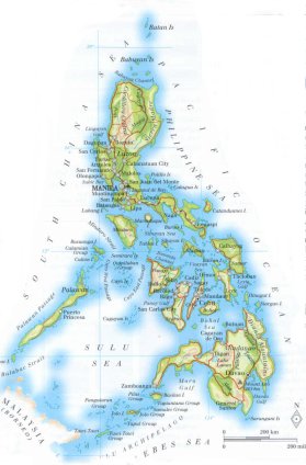
| islands: this country consists only of islands, see the separate file of the administrative division |
| deserts: none |
| other natural features: |
| Additional remarks, especially on the statistical information |
| other important features: |
| apart from physical landmarks most of the above figures are changeable, in most cases they date from the 1990's |
| primary sources used for the general information: |
| BB CA EV PW WA WB WR, and some national statistical yearbooks |
| particulars concerning population data: |
 To the page containing the population growth statistics of the country
 To the page containing the historical population growth statistics of the provinces
 To the page containing urban historical population statistics
 Back to the homepage of this website: POPULATION STATISTICS
Internet website:Latest modification of this page on 2004-03-02 by Jan Lahmeyer
© "populstat" site: Jan Lahmeyer