All countries of the world listed from A-Z:

or choose from the countries per continent below:


 |  |  |  |  |  |
 | SOUTH GEORGIA and the SOUTH SANDWICH ISLANDSgeneral data of the country |
| General useful information |
| Note: some data are of constant value, while other are due to changes, fluctuations etc. |
| Nation and population |
| official name (short form): South Georgia & South Sandwich Islands |
| country code ISO: GS //; - FIPS: SX |
| location: South Atlantic Ocean |
| time zone: -2 UT |
| surface (land) area: 3903 sq.km = 1507 sq.mi //; - area incl. inland waters: sq.km = sq.mi |
| geographical position in extreme co-ordinates: North: 54° S / South: 56° S / East: 26° W / West: 37° W |
| borders (land): none |
| borders (coastline): South Atlantic Ocean |
| climate: arctic maritime |
| Government |
| independent since: not yet |
| type of government: territory of the United Kingdom since 1773 |
| capital: Grytviken |
| administrative division: none |
| Population |
| total population: there are no permanent residents, there is some military and scientific personnel |
| total population according to the estimate of midyear 2000: //; or: ; 2001: //; or: 2002: |
| population density: per sq.km = per sq.mi |
| population growth: % //; - doubling time: years |
| birth rate: per 1000 |
| death rate: per 1000 |
| fertility rate: children per female |
| maternal mortality: per 100,000 |
| infant mortality (1-4 years): per 1000 |
| life expectancy: years (male: ; female: ) |
| age breakdown: 0-14 years: % //; - 15-59 years: % //; - 60+ years: % |
| urbanisation: % //; - urbanisation growth: % |
| percentage of urban population in the greatest city: % |
| Ethnic composition, language, religion |
| ethnic groups: most personnel is from British decents |
| languages: English |
| religious affiliation: |
| Health |
| daily food intake: calories per capita |
| population with access to safe water: % |
| people per physician: |
| people per hospital bed: |
| Education, literacy |
| school enrolment: primary education 6-11 years: % |
| school enrolment: secondary education: % |
| school enrolment: tertiary education 20-24 years: % |
| adult literacy: 100% (male: %; female: %) |
| Economy and infrastructure |
| Economy and trade |
| currency: |
| annual inflation rate: % |
| population below poverty line: % |
| Gross Domestic Product: USD per capita |
| GNI USD per capita //; - [ppp: ] |
| GDP growth: % |
| income: USD per capita |
| import: USD per capita //; - export: USD per capita |
| trade: USD per capita //; - or % of GDP |
| trade partners: GB |
| human development index: //; - position of the country in the world no.: |
| female labour force: % |
| unemployment: % |
| tourism: million |
| Economic activities in agriculture, fisheries, industry, mining, services, energy |
| land use: arable land: % //; - grass land: % //; - wooded area: % //; - arid land and desert: % |
| agriculture: labour force: % //; - part of agriculture in GDP: % |
| agricultural products: fish |
| livestock (1000s): asses: / buffaloes: / camels: / cattle: / goats: / horses: / mules: / pigs: / poultry: / sheep: |
| fish catch: metric tonnes |
| industry: labour force: % //; - part of industry in GDP: % |
| industrial products: |
| mining products: |
| CO2 emission per capita: |
| services: labour force: % //; - part of services in GDP: % |
| energy use (kg per capita): |
| electricity use (per capita): |
| annual water use (per capita): |
| Traffic, communication |
| road network: km //; - of which paved: % //; - of which are motorways: km |
| vehicles: per 1000 |
| railways: km //; - railways passenger/km: |
| navigable inland waterways: km |
| ownership telephone: per 1000 |
| ownership radio receivers: per 1000 |
| ownership tv-sets: per 1000 |
| newspaper circulation: per 1000 |
| persons per post office: |
| personal computers: per 1000 |
| Some physical landmarks |
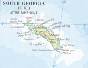
| mountains: Mt. Paget 2934 m (on South Georgia) |
| lowest point: sea level |
| lakes (natural): none, or unknown |
| lakes (artificial reservoirs): none, or unknown |
| lakes (deepest): unknown |
| rivers: none, or unknown // canals: none |
| waterfalls: none, or unknown |
| caves: longest system: none, or unknown / deepest: |
| islands: see the separate file of the islands |
| deserts: none |
| other natural features: |
| Additional remarks, especially on the statistical information |
| other important features: |
| apart from physical landmarks most of the above figures are changeable, in most cases they date from the 1990's |
| there are hardly enough detailed data found in the sources used / discovered by James Cook |
| formerly administered by the Falkland Islands, became separate dependency in 1985 |
| primary sources used for the general information: |
| BB CA EV PW WA WB WR, and some national statistical yearbooks |
| particulars concerning population data: |
There is no separate file of population growth of the country, because there is - or was - hardly any resident population.
 To the page containing some statistics of the islands
 To the page containing information of the settlements
 Back to the homepage of this website: POPULATION STATISTICS
Latest modification of this page on 2004-03-05 by Jan Lahmeyer
© "populstat" site: Jan Lahmeyer